(UPDATED 5:30AM) 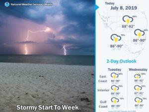
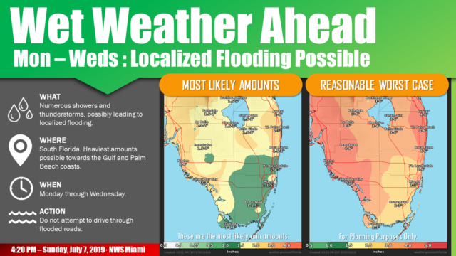
Tuesday will be rainy and mostly cloudy as well, with a passing storm not out of the question. Tuesday‘s highs will be in the upper 80s.
Wednesday will feature lots of clouds and periods of showers, with greatest coverage along the Gulf coast and in the interior. Wednesday‘s highs will be near 90 degrees.
We’ll see how any tropical development well to our north could affect South Florida’s weather on Thursday and beyond, but for now, we’ll say Thursday will continue the trend of mostly cloudy skies and periods of showers. Thursday’s highs will be mostly in the low 90s.
Friday’s forecast (for now) is for a mix of sun, clouds, and showers for the east coast metro area, while clouds and showers continue to dominate the Gulf coast and the interior. Highs on Friday will be in the low 90s.
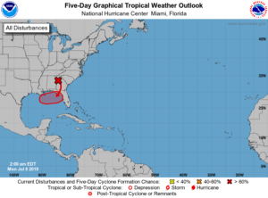 While there’s no tropical development right now, computer models continue to indicate that a low is likely to form in the northeastern Gulf of Mexico by late in the workweek. The National Hurricane Center is giving this potential feature a high chance of developing into a tropical depression. Because this feature is likely to hover near the Florida panhandle, we’ll watch this scenario closely in the days ahead.


