


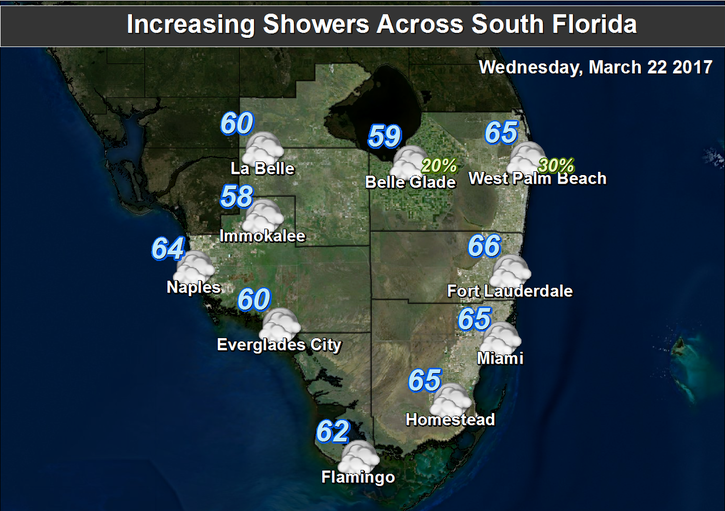
 South Florida will enjoy a pleasant day today, but changes are coming. After a cool morning (with faint smoke in the air from brush fires in the interior), Wednesday features good sun and a few clouds. A moderate risk of dangerous rip currents is in place for the beaches of Miami-Dade and Broward, while the rip current risk is high in Palm Beach County. Highs on Wednesday will reach the low 80s. But clouds will build and showers move in on increasing winds as a front moves in.
Look for windy conditions and periods of showers on Thursday. Even with clouds and showers, Thursday’s highs will top out near the 80 degree mark.
Friday will bring showers on a strong ocean breeze, and the risk of dangerous rip currents will increase at the Atlantic beaches (and be at high levels into the weekend). Highs on Friday will be near 80 degrees.
Saturday will be breezy, and we’ll see a few showers along with a mix of sun and clouds. Saturday afternoon highs will be in the low 80s.
Sunday’s forecast includes good sun, a few clouds and showers, and gentler breezes. Highs on Sunday will be in the low 80s.


")
")
")


