


 South Florida will see a breezy Monday with passing showers to start off a wet workweek. After some early east coast and Keys showers, Monday features some sun, clouds and passing showers on the breeze (especially in Miami-Dade and Broward), and highs in the mid to upper 80s.
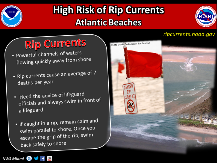 A high risk of rip currents is in place along the Atlantic beaches on Monday through Friday. The coastal flood advisory remains in effect for tidal flooding in low-lying areas of Miami-Dade and Broward at least through Tuesday.
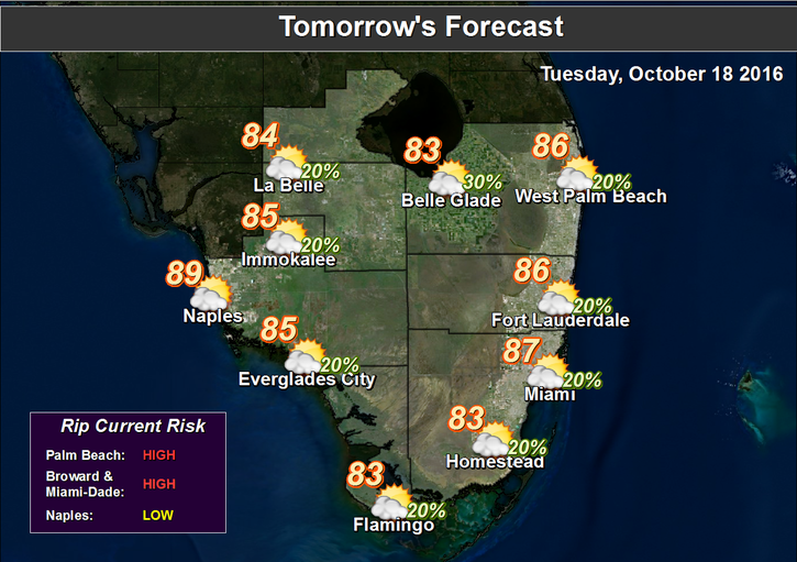 We’ll see more showers around on the breeze on Tuesday, and an isolated storm is possible. Tuesday’s highs will be in the mid 80s.
Passing showers on the ocean breeze, periods of sun, and highs in the mid to upper 80s are in the forecast for Wednesday and Thursday.
Again, Gulf coast locations will be a bit drier than the east coast. Look for sun, clouds, and hit-or-miss showers on Friday, with highs reaching the mid 80s.
We’re watching a cold front to our north that computer models indicate could make it all the way to South Florida over the weekend.
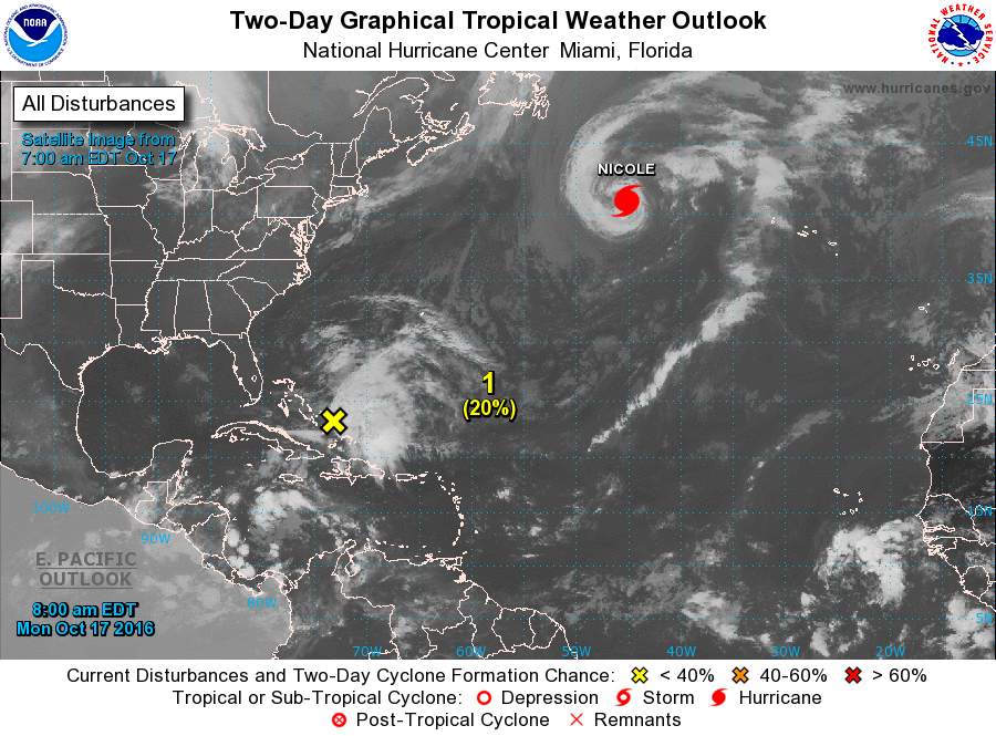 Hurricane Nicole is still hanging on and producing high surf way beyond its track. At 5 am Monday, Nicole was located near 41.0 North, 45.2 West, and was moving northeast at 9 miles per hour. Maximum sustained winds were 75 miles per hour, and Nicole should finally lose its tropical characteristics in the far north Atlantic.
Elsewhere in the tropics, an area of showers just east of the Bahamas has a medium chance of developing over the next couple of days as it moves generally to the north.


