


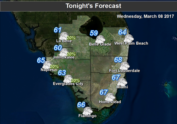
 It’s not so breezy today in South Florida, but we’ll still see some clouds and showers blowing by. After a mild morning with a few showers around, the day features some sun, along with clouds and isolated showers on the ocean breeze. The risk of dangerous rip currents at the Atlantic beaches will gradually diminish from high to moderate levels as Wednesday progresses. Highs today will be near 80 degrees, with slightly cooler readings right at the coast.
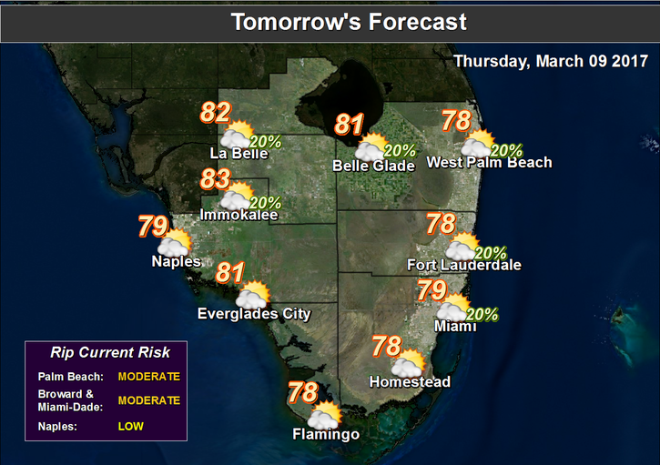 Thursday will bring a few showers and a mix of sun and clouds, as a weak front washes out to our north. Thursday’s highs will be near 80 degrees.
Friday features good sun, some clouds around, and a few stray showers at times. Highs on Friday will be in the low 80s.
The forecast for Saturday includes a mix of sun and clouds, along with the possibility of some late showers as yet another weak front washes out to our north. Highs on Saturday will be mostly in the low 80s, with a few higher readings well inland.
Remember to set your clocks forward one hour late on Saturday to get ready for the start of Daylight Saving Time early Sunday morning.
Our “shorter” Sunday features a mix of sun and clouds and a few showers in spots. Sunday’s highs will be in the low to mid 80s.


