


 South Florida will see most of the day’s showers early on a hot and sticky Sunday. Look for morning showers on an ocean breeze, followed by sun, clouds, a high risk of dangerous rip currents at the Atlantic beaches, and just an isolated shower in the afternoon. Sunday’s highs will be in the low 90s.
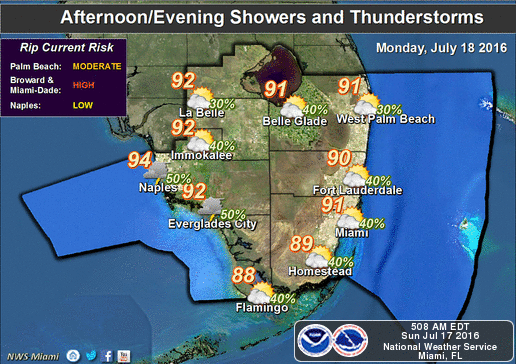 Rain chances increase on Monday as tropical moisture moves in. The day features clouds, passing showers and a few storms, and highs near 90 degrees.
We’ll see the tropical moisture (and the widespread showers and storms) again on Tuesday and Wednesday. Highs on Tuesday will be near 90 degrees, and Wednesday will see afternoon temperatures in the low 90s.
Some early showers and afternoon storms in spots are in Thursday’s forecast, along with highs in the low 90s.


")
")
")


