


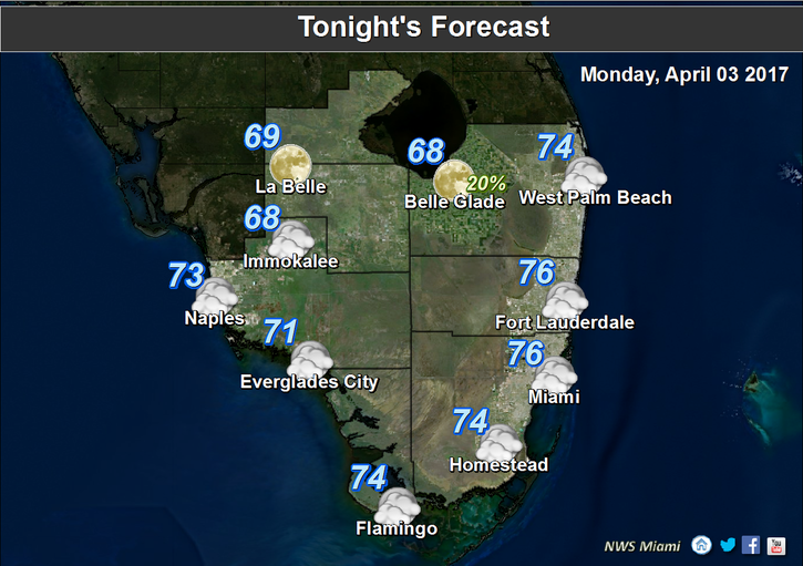
 South Florida will see a mix of weather today. After a warm morning with passing showers in spots, the day features some sun, clouds and showers on a strong and gusty breeze, and a moderate risk of dangerous rip currents at the Atlantic beaches (remaining through midweek). Monday’s highs will be mostly in the mid 80s, with a few higher readings in the western suburbs.
Tuesday will bring a mix of sun and clouds, with just the possibility of a stray shower in spots. Highs on Tuesday will be in the muggy upper 80s.
Wednesday features more sun, fewer clouds, and maybe a stray shower. Wednesday’s highs will be in the upper 80s and feel even warmer.
Thursday will begin with a mix of sun and clouds as a front approaches. Then we’ll see building clouds and some storms in the afternoon and evening as the front moves in.
The front will cool us down, and Friday’s highs will be near the 80 degree mark. Friday will also feature a mix of sun and clouds.


