
Home Weather Severe Storms Likely Friday Night Across Florida

Severe Storms Likely Friday Night Across Florida

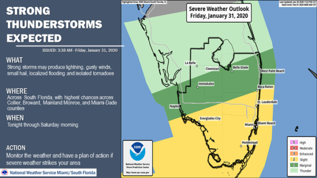
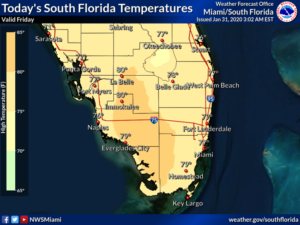
Friday will be unsettled, with early fog giving way to morning sun and clouds.  Then showers and storms will move in, with the likelihood of strong to severe storms during the evening into Saturday morning.  Be ready for dangerous lightning, damaging winds, heavy rain, and the possibility of isolated tornadoes.  A high risk of dangerous rip currents is in place along the Palm Beach County coast, and there’s a moderate risk of rip currents at the beaches of Miami-Dade and Broward.   Highs on Friday will be in the upper 70s.

LIVE RADAR 24/7 (Click Here Then Press Play)

After a stormy start on Saturday, we’ll see lots of clouds with periods of showers as a front moves in.  Saturday’s highs will be in the mid to upper 70s.

Sunday morning will be on the chilly side, with lows in the 50s.  The day will be sunny but cool.  Sunday’s highs will be in the low 70s.

Monday will be off to a chilly start again, with lows in the low 50s.  Then we’ll see plenty of sun and a few clouds.  Monday’s highs will be in the mid 70s.

Tuesday’s forecast includes good sun and some clouds at times.  Highs on Tuesday will be in the upper 70s.

Donna Thomas has studied hurricanes for two decades. She holds a PhD in history when her experience with Hurricane Andrew ultimately led her to earn a degree in broadcast meteorology from Mississippi State University. Donna spent 15 years at WFOR-TV (CBS4 in Miami-Fort Lauderdale), where she worked as a weather producer with hurricane experts Bryan Norcross and David Bernard. She also produced hurricane specials and weather-related features and news coverage, as well as serving as pool TV producer at the National Hurricane Center during the 2004 and 2005 seasons. Donna also served as a researcher on NOAA's Atlantic Hurricane Database Reanalysis Project. Donna specializes in Florida's hurricane history.