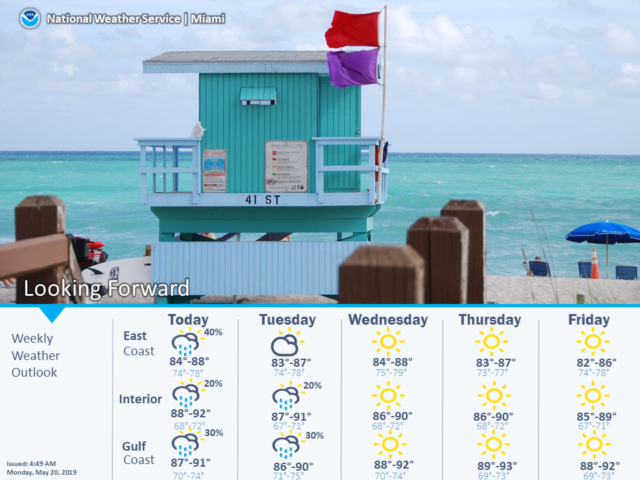
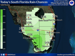
 South Florida could see a few afternoon storms on Monday while we keep an eye on the tropical Atlantic for development far to our east. Here at home, Monday features good sun, a few clouds, and the chance of an east coast shower to start. Then we’ll see a few storms pop up in the afternoon. An elevated risk of dangerous rip currents is still an issue at the Atlantic beaches on Monday. Highs on Monday will be mostly in the upper 80s.
Tuesday will bring plenty of sun and a few clouds. Tuesday’s highs will be in the upper 80s.
Wednesday will feature good sun and a few clouds in spots. Wednesday’s highs will be in the mid 80s in the east coast metro area and near 90 degrees elsewhere.
Thursday will start with plenty of sun, but then east coast locations could see an afternoon storm. Thursday’s highs will be in the mid 80s at the east coast and around the 90 degree mark elsewhere.
Friday’s forecast includes sunny skies around South Florida plus breezy conditions at the east coast. Highs on Friday will be in the mid to upper 80s at the Atlantic coast and near 90 degrees elsewhere.
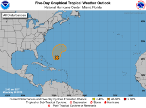 With hurricane approaching, we have a low forming in the Atlantic several hundred miles east of the Bahamas. This feature has a window of opportunity to develop into a tropical or subtropical depression late on Monday or early on Tuesday, but then conditions will become hostile for development. Overall, the National Hurricane Center gives this feature a moderate chance of actually developing into a depression. It’s no threat to South Florida but a reminder (if we need one) to get prepared for hurricane season.


