


 The storms have exited South Florida early on Tuesday, and now cooler days are ahead. The front (part of the system that is bringing blizzard conditions to the Northeast) should clear the area by late morning on Tuesday, but not before bringing in some strong storms overnight, especially in northern Broward and Palm Beach counties. Tuesday will see clearing skies and fairly breezy conditions. Highs on Tuesday should approach the 80 degree mark.
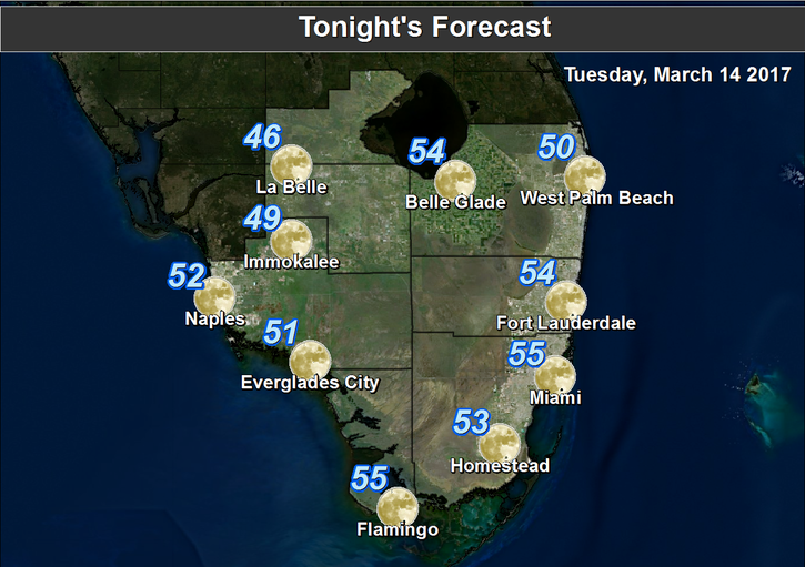
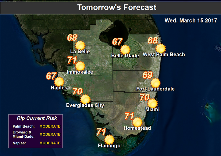 Then chilly air moves in during the evening, and Wednesday morning lows will be in the 50s. The day will feature good sun with a few clouds, but Wednesday’s highs will struggle to reach the 70 degree mark.
Thursday morning will be chilly, with lows ranging from the upper 40s to the low 50s right at the coast — and the breeze will make it feel even colder. Lots of sun will be around on Thursday, but afternoon highs will only reach the low 70s.
Friday will be off to a cool start, then the day will bring good sun and a few clouds for St. Patrick’s Day. Highs on Friday will be in the mid 70s.
The slow warming trend continues on Saturday, as highs reach the upper 70s. Look for plenty of sun and a few clouds on Saturday.


