

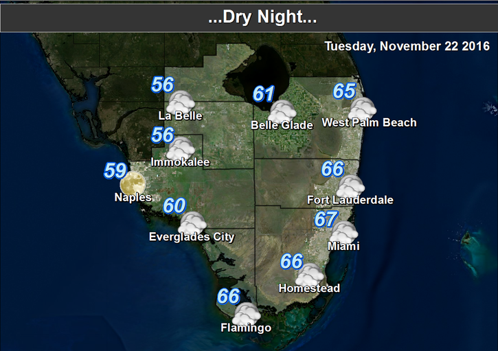
 Lots of sun will warm up South Florida after a cool start on Tuesday. After morning lows ranging from the mid 50s to low 60s, Tuesday will feature nice sun and highs in the upper 70s. But winds from the northeast will create a moderate risk of dangerous rip currents at the Atlantic beaches.
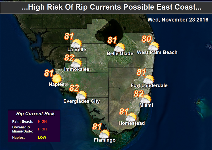 Wednesday will be breezy, with a mix of sun, clouds, and maybe a stray shower. The risk of dangerous rip currents will be elevated at the Atlantic beaches. Highs will approach the 80 degree mark on Wednesday.
Thanksgiving Day’s weather will be a blessing, with sun, clouds, maybe a shower in spots, and highs near 80 degrees.

A front approaches slowly on Friday, bringing sun, clouds, maybe a stray shower, and highs near 80 degrees for bargain hunters.
Saturday will see the front move through, so look for a few passing showers, and highs in the upper 70s.
Sunday will feature sun, clouds, and a few stray showers. Sunday’s highs will be in the upper 70s.
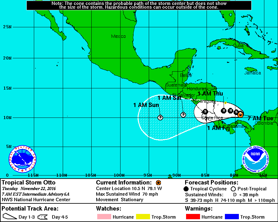 In the southwest Caribbean, what was Tropical Depression # 16 is now Tropical Storm Otto. At 4 am Tuesday, Otto was located near 10.7 North, 79.0 West, and was virtually stationary. Maximum sustained winds were 60 miles per hour, and Otto is forecast to reach hurricane strength before landfall in Nicaragua or Costa Rica on Thursday.
Disclaimer
Artificial Intelligence Disclosure & Legal Disclaimer
AI Content Policy.
To provide our readers with timely and comprehensive coverage, South Florida Reporter uses artificial intelligence (AI) to assist in producing certain articles and visual content.
Articles: AI may be used to assist in research, structural drafting, or data analysis. All AI-assisted text is reviewed and edited by our team to ensure accuracy and adherence to our editorial standards.
Images: Any imagery generated or significantly altered by AI is clearly marked with a disclaimer or watermark to distinguish it from traditional photography or editorial illustrations.
General Disclaimer
The information contained in South Florida Reporter is for general information purposes only.
South Florida Reporter assumes no responsibility for errors or omissions in the contents of the Service. In no event shall South Florida Reporter be liable for any special, direct, indirect, consequential, or incidental damages or any damages whatsoever, whether in an action of contract, negligence or other tort, arising out of or in connection with the use of the Service or the contents of the Service.
The Company reserves the right to make additions, deletions, or modifications to the contents of the Service at any time without prior notice. The Company does not warrant that the Service is free of viruses or other harmful components.


")


