Home Weather Cold Start To Wintry Week

Cold Start To Wintry Week

Cold Start To Wintry Week

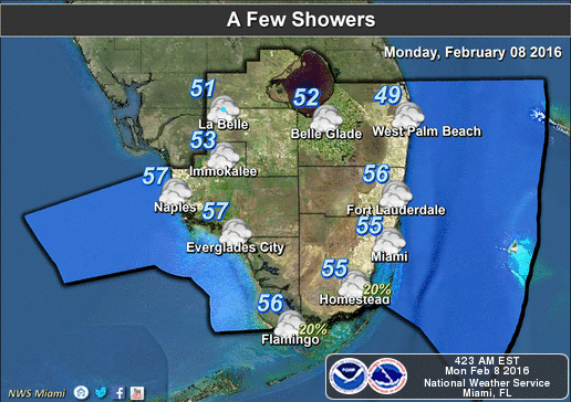
South Florida is feeling a stretch of winter weather this week, beginning with a cold Monday morning.
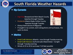
Cold Start To Wintry WeekAfter lows in the 40s, Monday will feature plenty of sun before clouds build in later in the afternoon. Highs will just reach the mid 60s. A high risk of dangerous rip currents is in place on what is definitely not a beach day.

Tuesday morning will be just a bit warmer, with highs in the upper 40s to mid 50s, and we’ll see temperatures rise into the upper 60s. More cold air sweeps in late on Tuesday, and Wednesday morning will see lows back in the 40s.

Wednesday’s mix of sun and clouds will keep highs in the mid 60s.

Thursday will continue our stretch of unseasonably chilly weather, with highs sticking in the mid to upper 60s.

We’ll finally see the low 70s on Friday afternoon.

[vc_message message_box_style=”3d” message_box_color=”turquoise”]

By Donna Thomas, SouthFloridaReporter.com Meteorologist, Feb. 8, 2016 

[/vc_message]
[vc_btn title=”More Weather information” style=”outline” color=”primary” align=”center” css_animation=”appear” link=”url:http%3A%2F%2Fwww.srh.noaa.gov%2Fmfl%2F|title:More%20Weather%20information|target:%20_blank”]
Donna Thomas has studied hurricanes for two decades. She holds a PhD in history when her experience with Hurricane Andrew ultimately led her to earn a degree in broadcast meteorology from Mississippi State University. Donna spent 15 years at WFOR-TV (CBS4 in Miami-Fort Lauderdale), where she worked as a weather producer with hurricane experts Bryan Norcross and David Bernard. She also produced hurricane specials and weather-related features and news coverage, as well as serving as pool TV producer at the National Hurricane Center during the 2004 and 2005 seasons. Donna also served as a researcher on NOAA's Atlantic Hurricane Database Reanalysis Project. Donna specializes in Florida's hurricane history.