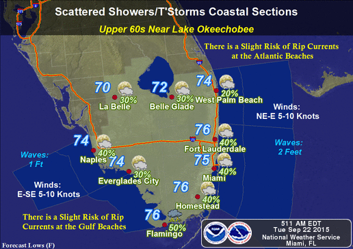
By Donna Thomas, SouthFloridaReporter.com Meteorologist, Sept. 22, 2015 – South Florida will see the return of afternoon storms on Tuesday. Look for early sun and a few showers, highs mostly in the upper 80s, and scattered storms in the afternoon and evening, including periods of heavy downpours in some locations.
Wednesday and Thursday will bring a few early showers, highs in the upper 80s, and some afternoon storms tapering off in the early evening. Showers and storms will be more widespread on Friday, with building clouds and highs in the mid to upper 80s. Saturday and Sunday could be on the rainy side if tropical moisture works its way into South Florida from a developing low near the Yucatan, but computer models are split on just how stormy the weekend will be.
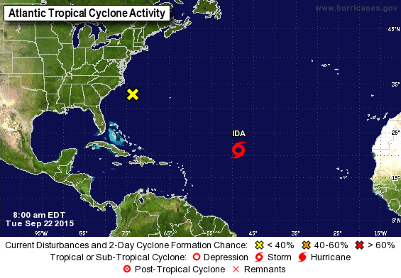
In the tropics, Tropical Storm Ida is meandering in the central Atlantic. At 5 am Tuesday, Ida was located near 21.3 North, 48.6 West, and was moving east-southeast at 5 miles per hour. Maximum sustained winds were 45 miles per hour. Ida is eventually expected to turn northwestward and then northward, but motion will be slow over the next several days. Elsewhere, a low a few hundred miles off the Carolina coast has a low chance of becoming a tropical or subtropical depression as it moves westward.


