


South Florida will start the workweek with clouds and passing showers, thanks to a stalled front. Monday will feature clouds and passing early showers, followed by some sun and developing afternoon storms, especially inland. Monday’s highs will be in the mid to upper 80s.
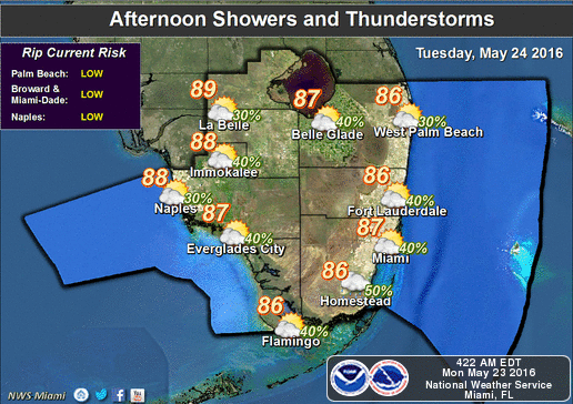 Some drier air will try to work in on Tuesday, but a few showers and afternoon storms remain in the forecast. Tuesday’s highs will be in the mid to upper 80s.
Look for ocean breezes and more sun on Wednesday through Friday, but we can’t rule out an early shower and a stray afternoon storm, especially inland. Highs will be in the upper 80s.
[vc_message message_box_style=”3d” message_box_color=”turquoise”]By Donna Thomas, SouthFloridaReporter.com Meteorologist, May 23, 2016[/vc_message]


