


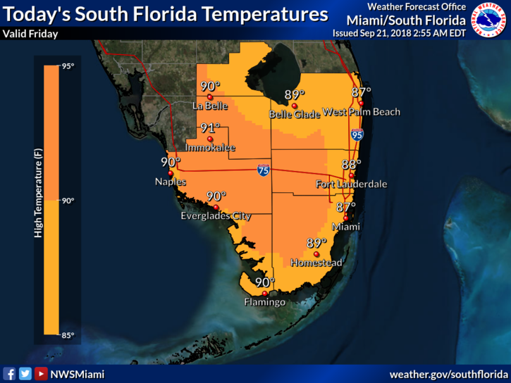
 Showers and storms will move into South Florida on Friday, and some will be around for the weekend. East coast locations will be dodging showers and storms from mid-morning into the afternoon. Then the Atlantic sea breeze will push the activity westward. Highs on Friday will be near 90 degrees.
We’ll see some early showers along the east coast on Saturday, and then afternoon showers and storms will pop up, especially well inland and along the Gulf coast. Saturday’s highs will be in the upper 80s right at the east coast and a bit warmer elsewhere.
Sunday will be another day with some sun and passing showers and storms. Sunday’s highs will be near 90 degrees.
Look for a few early showers along the east coast on Monday, followed by a few sea breeze showers and storms, especially in the interior. Monday’s highs will be near 90 degrees.
Tuesday’s forecast includes sun, clouds, and passing showers and storms in spots. Highs on Tuesday will be near 90 degrees.
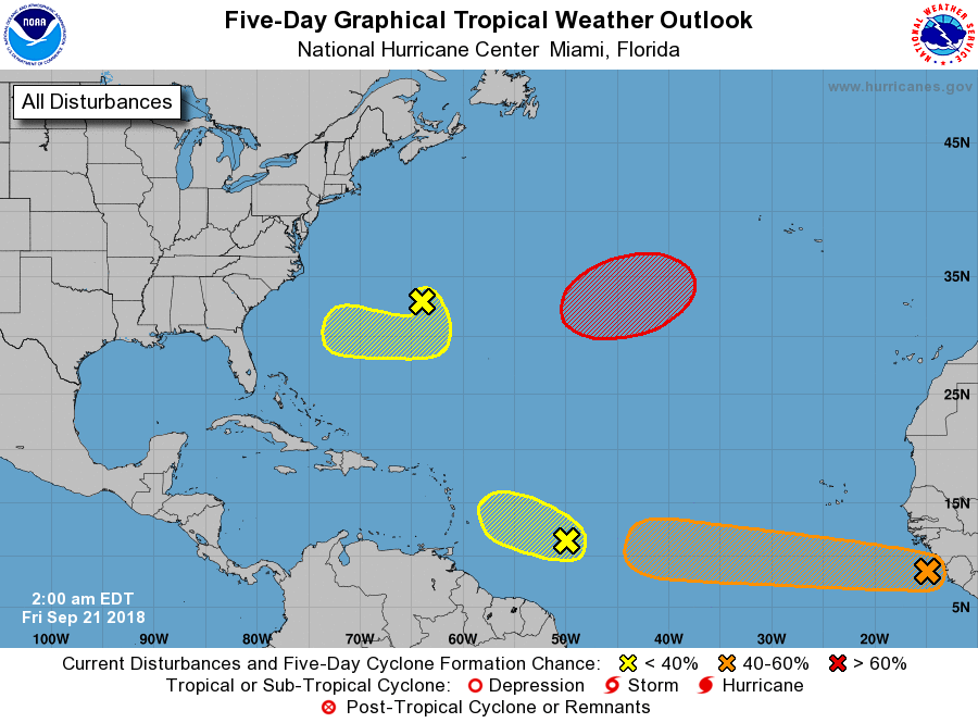 We’re watching several features in the tropics but nothing that’s developed yet. The wave about 650 miles east of the Windward Islands has a low chance of developing before it encounters unfavorable conditions. Another wave just off the coast of Africa has a medium chance of developing during the next 5 days as it moves westward. A low about 100 miles northeast of Bermuda has a low chance of developing as it meanders into early next week. And another low is expected to develop in the middle of the central Atlantic. This low will have a high chance of becoming a tropical or subtropical depression during the next few days.


