


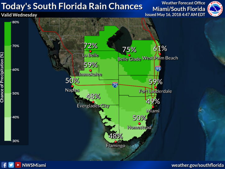
 South Florida is stuck in a weather pattern that is bringing us more showers and storms. Wednesday features some sun, building clouds, and showers and storms in the afternoon and evening. Localized flooding is possible as rain totals accumulate since Sunday. An elevated risk of dangerous rip currents remains at the Atlantic beaches on Wednesday. Highs on Wednesday will be in the mid 80s.
 Thursday will be another day of building clouds and afternoon showers and storms. Thursday’s highs will be in the mid 80s.
Friday will bring some sun, clouds, and showers and storms in the afternoon. Friday’s highs will be in the mid 80s.
We won’t see a let-up over the weekend. Saturday will feature clouds and mostly afternoon showers and storms. Saturday’s highs will be in the mid 80s.
Sunday will still be on the wet side, with periods of showers and storms. Highs on Sunday will be in the mid 80s. Welcome to the rainy season.
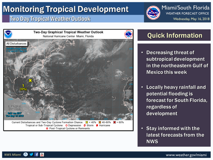
The low in the southeastern Gulf of Mexico is showing little organization and the threat of developing through Thursday has fallen to 10%, according to the National Hurricane Center. Regardless of development, locally heavy rainfall and the potential for flooding exist into the weekend across South Florida.


