


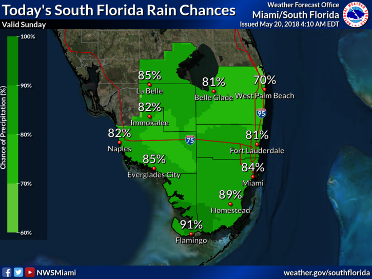
 South Florida can’t escape the rain on Sunday as we continue to deal with tropical moisture. After a rainy start, Sunday features plenty of clouds, passing showers, and some afternoon storms in spots. Accumulated rain will mean flooding is possible in some areas. An elevated risk of dangerous rip currents is in place at the Atlantic beaches. Sunday’s highs will be in the low 80s.
 Monday will bring clouds, maybe a bit of sun, and definitely periods of showers and storms. Monday’s highs will be in the mid 80s.
We’ll see more typical rainy season weather on Tuesday, with a mix of sun and clouds early, followed by afternoon showers and storms along the sea breeze on each coast. Tuesday’s highs will be in the mid 80s.
Wednesday will feature more of the same — some sun, some clouds, and showers and storms along the sea breeze in the afternoon and early evening. Wednesday’s highs will be in the mid 80s.
Thursday will continue the pattern of sun, clouds, and afternoon showers and storms, as we wait for another round of tropical moisture to move in at the end of the workweek. Highs on Thursday will be in the mid 80s.


