


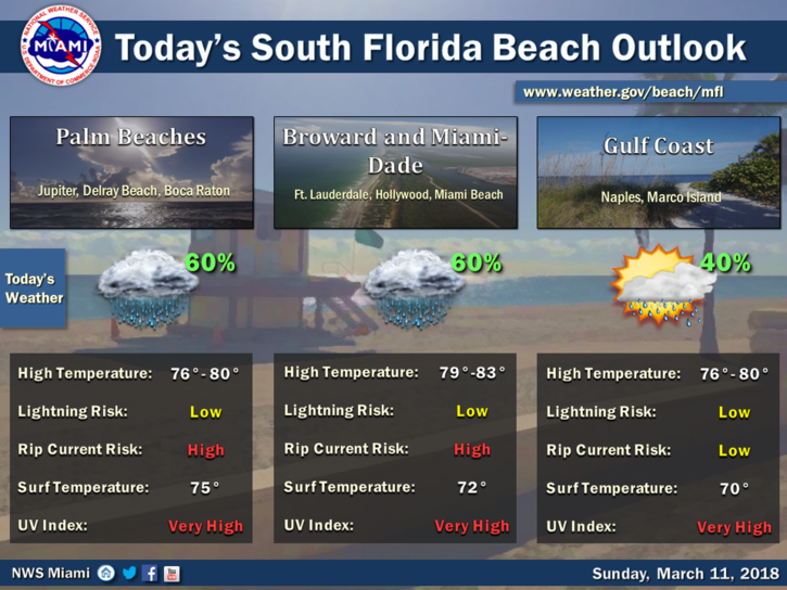
 South Florida will be warmer with some lingering showers around on Sunday. After overnight showers (heavy in spots), Sunday features a mix of clouds and showers with periods of sun at times. A high risk of dangerous rip currents remains at the Atlantic beaches on Sunday. Highs on Sunday will be in the low 80s.
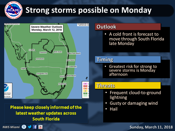 Monday will bring another front, and in advance of it, we’ll see clouds, showers, and storms. Some of those storms could be strong, with heavy rain, gusty winds, and dangerous lightning. Monday’s highs will be mostly in the low 80s.
A few showers will linger on Tuesday, but mostly we’ll see sun and clouds as cooler air seeps in. Tuesday’s highs will be in the mid 70s.
Wednesday will feature sun, a few clouds, and maybe a stray shower. Wednesday’s highs will be in the low to mid 70s.
Look for good sun and a few clouds at times on Thursday. Highs on Thursday will be in the mid 70s.


