


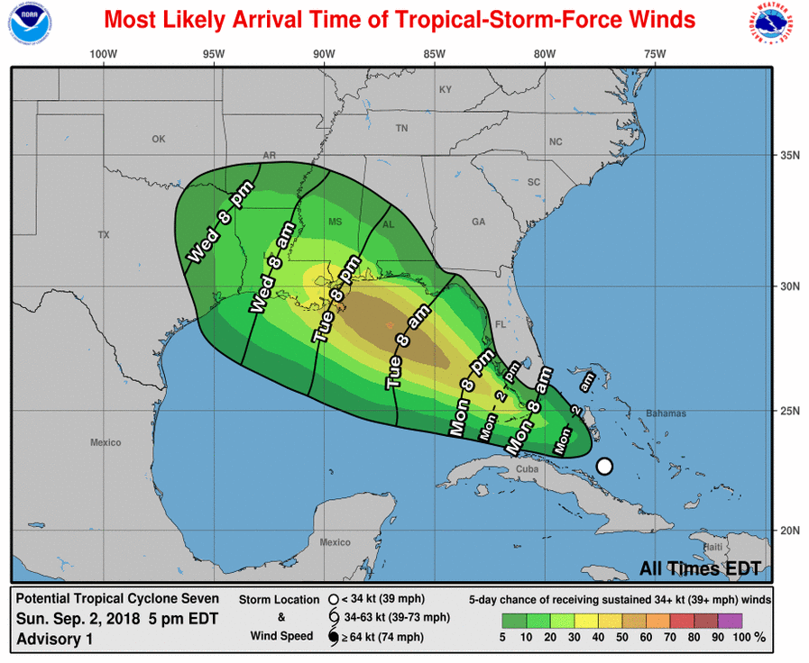
 The wave we’ve been watching for a while is now Potential Tropical Depression # 7, and the National Hurricane Center is issuing advisories on it as it approaches South Florida. The system now has a high chance of developing into a depression early on Monday.
Portions of the Keys could experience tropical storm force winds and all of South Florida can expect heavy rain and gusty winds as Potential TD # 7 moves past our area on Labor Day.
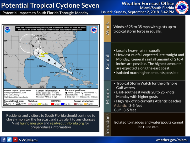 At 5 pm Sunday, Potential TD # 7 was located near 22.7 North, 77.3 West, or about 275 miles east-southeast of Marathon. Potential TD # 7 had maximum sustained winds of 30 miles per hour — but not a closed circulation as of late Sunday afternoon. The system is moving west-northwest at 15 miles per hour.
A tropical storm watch is in effect from the Florida-Alabama border to just east of Morgan City, Louisiana.


