


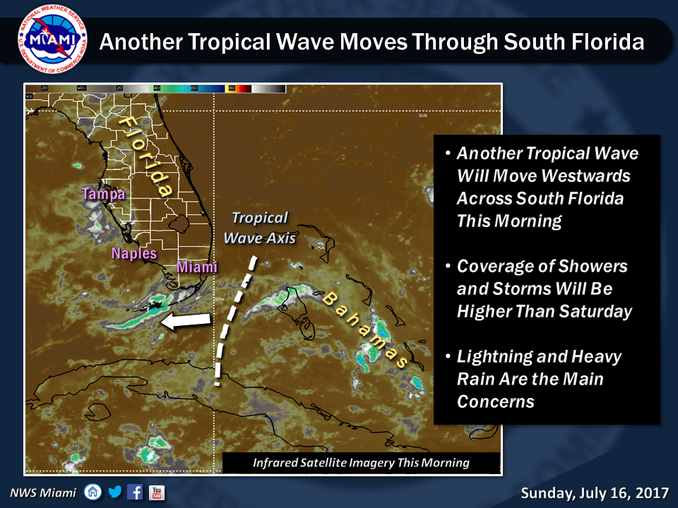
 Showers and storms will return to South Florida on Sunday, thanks to tropical moisture from a wave to our south. After some early sun, look for showers and some storms to pass through from late morning and last into the afternoon. Periods of heavy rain are possible, especially in the Keys and southern Miami-Dade. A moderate risk of dangerous rip currents is in place at the beaches in Palm Beach County, with the risk decreasing at the beaches in Broward and Miami-Dade. Highs on Sunday will be in the low 90s.
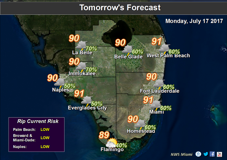 Rain chances will remain on the high side on Monday, with periods of showers and a few storms. Highs on Monday will be in the low 90s.
Tuesday will be on the wet side as well, with passing showers and storms in spots. Tuesday’s highs will be in the low 90s.
Wednesday will see a few early coastal showers, sun and clouds, and afternoon storms in spots as the sea breeze develops. Wednesday’s highs will be in the low 90s.
Thursday’s forecast includes a few early showers, some sun, and spotty afternoon storms. Highs on Thursday will be in the low 90s.
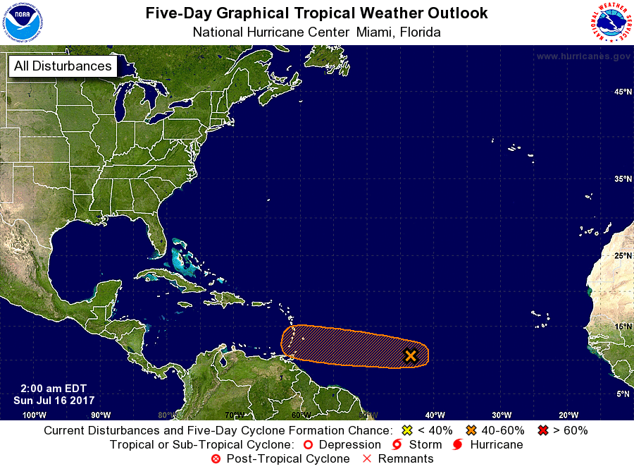 In the tropics, a wave in the central Atlantic is showing signs of slow development. The National Hurricane Center gives it a medium chance of becoming a depression during the next 5 days.


