|
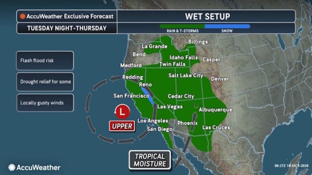
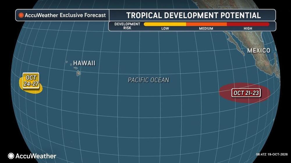
People from western Mexico into the southern Plains in the U.S. need to closely monitor the developing tropical threat as moisture from the system could eventually stream north. AccuWeather hurricane experts are tracking a high risk for tropical development southwest of Mexico from Oct.21-23, as conditions are expected to favor the formation of a tropical system in the eastern Pacific Ocean. “Residents and businesses across western Mexico should closely monitor the progress of this developing system. The exact track of the system will play an important role in determining whether it brings impacts to western Mexico or remains offshore,” said AccuWeather Lead Hurricane Expert Alex DaSilva. This latest development risk follows a recent busy stretch of tropical activity, one storm right after the other and some at the same time, in the eastern Pacific including Polo, Simon, Rachel, and Trudy. This continued activity highlights the importance of monitoring tropical development off Mexico’s Pacific coast, even when a storm’s center is expected to remain offshore. |

 |
Disclaimer
Artificial Intelligence Disclosure & Legal Disclaimer
AI Content Policy.
To provide our readers with timely and comprehensive coverage, South Florida Reporter uses artificial intelligence (AI) to assist in producing certain articles and visual content.
Articles: AI may be used to assist in research, structural drafting, or data analysis. All AI-assisted text is reviewed and edited by our team to ensure accuracy and adherence to our editorial standards.
Images: Any imagery generated or significantly altered by AI is clearly marked with a disclaimer or watermark to distinguish it from traditional photography or editorial illustrations.
General Disclaimer
The information contained in South Florida Reporter is for general information purposes only.
South Florida Reporter assumes no responsibility for errors or omissions in the contents of the Service. In no event shall South Florida Reporter be liable for any special, direct, indirect, consequential, or incidental damages or any damages whatsoever, whether in an action of contract, negligence or other tort, arising out of or in connection with the use of the Service or the contents of the Service.
The Company reserves the right to make additions, deletions, or modifications to the contents of the Service at any time without prior notice. The Company does not warrant that the Service is free of viruses or other harmful components.