


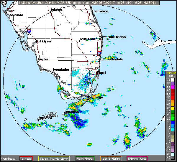
 Showers and storms will be passing through South Florida on Tuesday as tropical moisture from that wave we’ve been watching arrives. Tuesday features clouds, showers, and storms, with some areas seeing heavy downpours and localized flooding. Highs on Tuesday will be near 90 degrees.
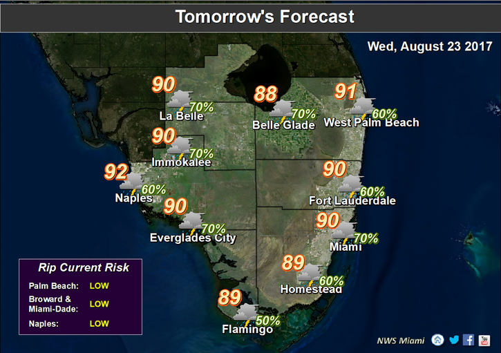 Showers and storms hang around on Wednesday, and the accumulated rainfall will make localized flooding more likely. Wednesday’s highs will be near 90 degrees.
Thursday will bring additional showers and storms. Highs on Thursday will be near 90 degrees. The wet pattern continues on Friday even as the wave (whether it develops or not) moves away, so look for clouds, showers, and storms.
Friday’s highs will be near 90 degrees. Saturday’s forecast won’t be much of an improvement — clouds, a bit of sun, and passing showers and storms. Saturday’s highs will be near 90 degrees.
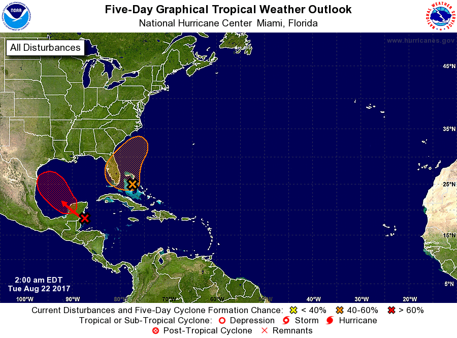 In the tropics, the wave that’s bringing us tropical moisture has a low chance of developing as it hangs around during the next two days. It has a medium chance of developing beyond that, as it moves to the northeast and away from us. The remnants of Harvey aren’t expected to regain depression strength over Central America and the Yucatan. But the system has a high chance of redeveloping in a day or two as it emerges in the Bay of Campeche.


