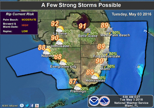
South Florida will be hot hot hot on Tuesday as rain returns to the forecast. After a warm morning, look for sun, clouds, highs near 90 degrees, and some afternoon and evening showers.
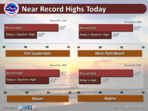
The National Weather Service (NWS) expects near record warm temperatures across South Florida today.
We also set a record warm low at Fort Lauderdale yesterday, where we only got down to 78°F, breaking the old record of 77°F last set in 2014.
West Palm Beach tied their record low of 77°F on Monday, last set in 2011.
Here’s a look at the records for today:

A few showers will linger early on Thursday until the front clears South Florida, then look for drier and slightly cooler conditions, with highs in the seasonable mid 80s.
Friday will be pleasant, with morning lows back in the 60s and highs in the low to mid 80s. That pattern will continue on Saturday.
[vc_message message_box_style=”3d” message_box_color=”turquoise”]By Donna Thomas, SouthFloridaReporter.com Meteorologist, May 3, 2016[/vc_message](From YouTube)


