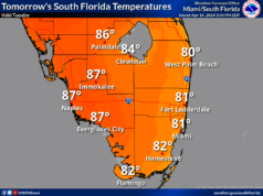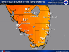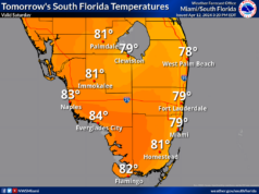
Monday features lots of sun, a few clouds at times, and just the chance of a stray shower in the east coast metro area and the Keys. A high risk of dangerous rip currents remains at the Atlantic beaches. Highs on Monday will be in mostly the mid-80s in the east coast metro area and the Keys and in the upper 80s along the Gulf Coast.
Tuesday will bring plenty of sun, but the east coast area will see building clouds and a shower in spots during the mid to late afternoon. Look for an elevated risk of dangerous rip currents at the Atlantic beaches. Tuesday’s highs will be in the mid-80s right at the Atlantic coast and the Keys and in the upper 80s elsewhere in South Florida.
Wednesday will feature a mix of sun and clouds in the east coast and in the Keys, while the Gulf Coast will be sunny again. Look for passing showers in the east coast metro area and a few afternoon storms along the Gulf Coast. Wednesday’s highs will be mostly in the low 90s in the east coast metro area, near 90 degrees along the Gulf Coast, and in the mid-80s in the Keys.
Thursday will begin with good sun and a few clouds, but showers and storms will develop during the mid-afternoon into the early evening. Thursday’s highs will be in the upper 80s in the east coast metro area, the low 90s along the Gulf Coast, and mostly in the mid-80s in the Keys.
Friday’s forecast calls for a mix of sun, showers, and a few storms. Highs on Friday will be in the mid-80s in the east coast metro area and the Keys and near 90 degrees along the Gulf Coast.


