


 South Florida will see both sun and storms today. The day features periods of sun, some late morning showers on a strong ocean breeze, an elevated risk of dangerous rip currents at the Atlantic beaches (a high risk in Palm Beach County), and afternoon storms forming along the sea breeze. Heavy rainfall is possible in spots, and we could see some localized flooding. Highs on Saturday will be near 90 degrees.
Sunday will see some sun and not quite as many showers and storms, and rip currents will continue to be a hazard at the Atlantic beaches. Sunday’s highs will be near 90 degrees.
Moisture will linger as the workweek begins on Monday, so look for sun and passing showers and storms. Highs on Monday will be near 90 degrees.
Tuesday will bring a few early showers, afternoon storms in spots, and a mix of sun and clouds. Tuesday’s highs will be near 90 degrees.
Drier air will influence our weather on Wednesday, so we’ll see sun, clouds, and just a few showers, mostly in southern parts of the area. Highs on Wednesday will be near 90 degrees.
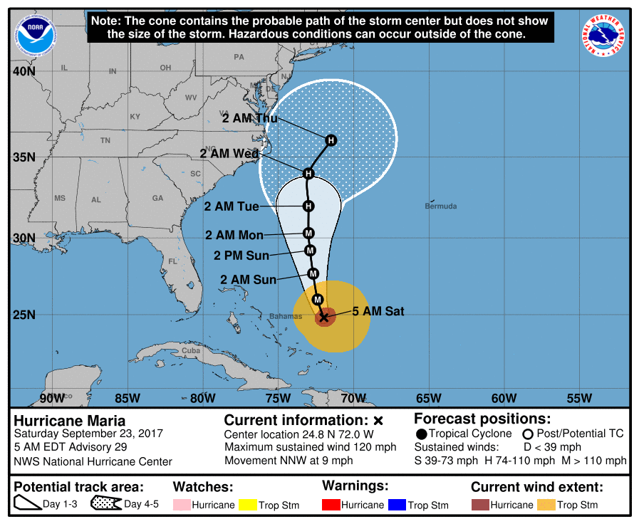 In the tropics, Hurricane Maria is passing east of the central and northwestern Bahamas. At 5 am Saturday, Maria was located near 24.8 North, 72.0 West, and was moving north-northwest at 9 miles per hour. Maximum sustained winds were 120 miles per hour. Maria will bring rough surf and rip currents to the southeast U.S. coast this weekend.
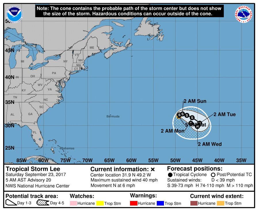 Elsewhere, we have a regenerated (but weak) Tropical Storm Lee. Early on Saturday, it was located near 31.9 North, 49.2 West, and was moving north at 6 miles per hour. Maximum sustained winds were 40 miles per hour. Lee is expected to remain in the central Atlantic.


