
Home Weather Sun, Clouds, and Some East Coast Storms

Sun, Clouds, and Some East Coast Storms

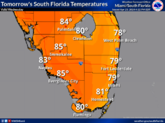
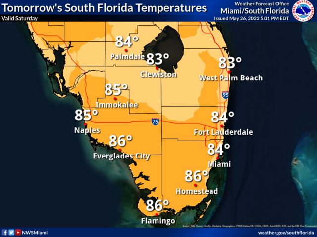
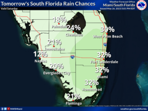
Saturday features good sun and a few clouds at times.  The east coast metro area will also see some afternoon storms at times, which could bring periods of heavy rain and localized flooding.  A high risk of dangerous rip currents is in place along the Palm Beach County coast this weekend.  Expect an elevated rip current risk — possibly a high risk — at the beaches of Broward and Miami-Dade during the weekend.  Highs on Saturday will be in the mid 80s right at the Atlantic coast and in the upper 80s elsewhere in South Florida.

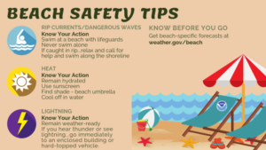
Beach Safety Tips -Rip Currents/Dangerous Waves: Swim at guarded beaches, never swim alone, if caught in a rip…relax, call for help, and swim along the shoreline. -Heat: Remain hydrated, use sunscreen, and cool off in the water. -Lightning: Remain weather ready and head indoors or into a hard-topped vehicle if you hear thunder.

Safe Boating Tips -High Winds/Waves: Reduce speed and head to shore. -Lightning: Remain weather-ready. If you hear thunder, it’s time to head to shore.

LIVE RADAR 24/7 (Click Here Then Press Play)

Sunday will bring good sun alternating with periods of showers and storms to the east coast metro area.  The Gulf coast and the Keys will see plenty of sun and a few afternoon storms in spots.  Sunday’s highs will be mostly in the upper 80s.

Memorial Day will feature partly sunny skies and some afternoon storms in the east coast metro area, while the Gulf coast and the Keys will see plenty of sun and a few clouds.  Monday’s highs will be in the upper 80s.

Tuesday will see a mix of sun, clouds, and afternoon storms in the east coast metro area.  The Gulf coast will be mostly sunny with a few passing storms in the late afternoon.  Tuesday’s highs will be in the upper 80s in the east coast metro area and the Keys and near 90 degrees along the Gulf coast.

Wednesday’s forecast calls for a mix of sun and clouds with periods of showers and storms.  Highs on Wednesday will be mostly in the upper 80s in the east coast metro area and the Keys and in the low 90s along the Gulf coast.

In the tropics, the area of disorganized showers and storms near the coast of Georgia and South Carolina is not expected to become a tropical or subtropical depression.  But it will bring heavy rain, gusty winds, and dangerous surf conditions to the Georgia and Carolinas coastal region during the holiday weekend.


Donna Thomas has studied hurricanes for two decades. She holds a PhD in history when her experience with Hurricane Andrew ultimately led her to earn a degree in broadcast meteorology from Mississippi State University. Donna spent 15 years at WFOR-TV (CBS4 in Miami-Fort Lauderdale), where she worked as a weather producer with hurricane experts Bryan Norcross and David Bernard. She also produced hurricane specials and weather-related features and news coverage, as well as serving as pool TV producer at the National Hurricane Center during the 2004 and 2005 seasons. Donna also served as a researcher on NOAA's Atlantic Hurricane Database Reanalysis Project. Donna specializes in Florida's hurricane history.