


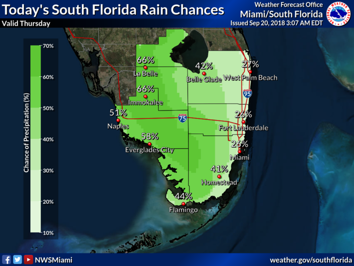
 Showers and storms are around South Florida on Thursday and will hang around through the weekend. Thursday starts with sun and clouds until showers and storms form along the sea breezes, particularly well inland and along the Gulf coast. Highs on Thursday will be in the low 90s in most locations and near 90 degrees right at the Atlantic coast.
Friday will bring additional moisture, leading to more widespread showers and storms. Friday’s highs will be mostly in the upper 80s.
Saturday will feature some sun, clouds, and periods of showers and storms, especially in western locations. Saturday’s highs will be near 90 degrees.
Sunday will be yet another day of passing showers and storms, but drier air will be on the way. Sunday’s highs will be near 90 degrees.
Look for sun, clouds, and a few afternoon showers and storms in spots on Monday. Highs on Monday will be near 90 degrees.
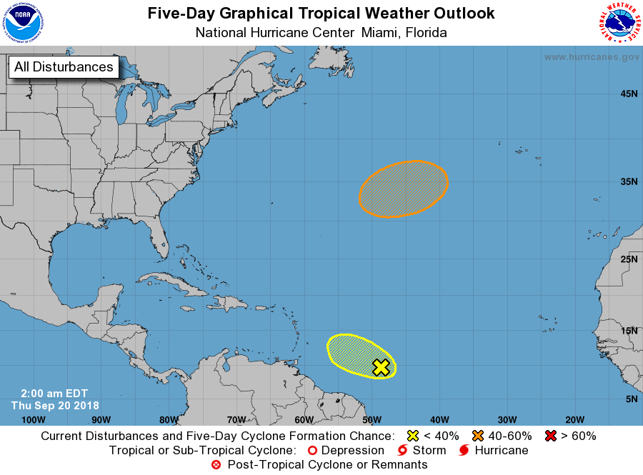 We’re watching only one feature in the tropical Atlantic: a wave about 850 miles east of the Windward Islands. This wave has a low chance of developing by the weekend, and it will encounter hostile winds after that.


")