


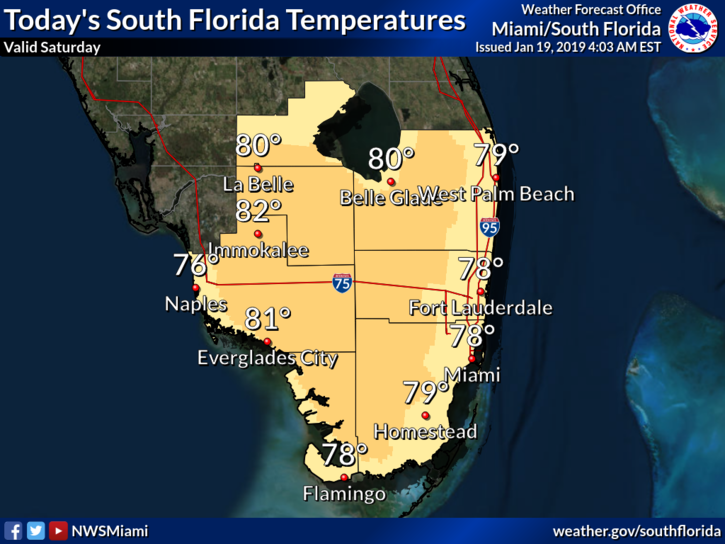
 South Florida will see weather changes this weekend, beginning on Saturday night. To start, Saturday will feature warm sun and building clouds during the daytime hours. Highs on Saturday will be near 80 degrees. Showers and maybe a storm will move in during the night as a strong front approaches.
Sunday will bring clouds and showers until much colder air arrives at night. Sunday’s highs will be in the mid 70s in the east coast metro area and near 70 degrees along the Gulf coast.
Monday morning will be cold, with lows in the 40s throughout South Florida. Look for sunny skies for parades and ceremonies honoring Dr. Martin Luther King. Monday’s highs will be in the upper 60s.
The cooldown won’t last, and even Tuesday morning’s lows will be back in the 50s. The day will feature a mix of sun and clouds. Tuesday’s highs will be in the mid 70s.
Wednesday will be breezy, with sun, clouds, and some east coast showers. Highs on Wednesday will be near 80 degrees.


