


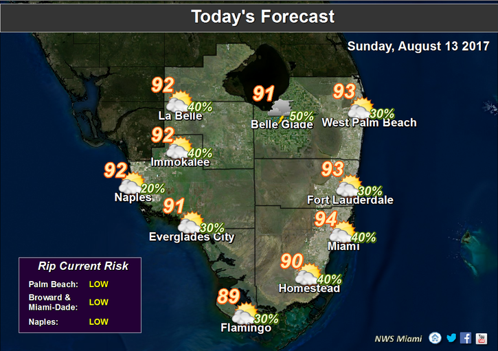
 It’s a summery Sunday in South Florida, with hot sun and a few showers and storms. After another warm start with a stray early shower, Sunday features a mix of hot sun and clouds, followed by some afternoon storms forming along the sea breeze. Most of the storms should be well inland, but the western suburbs (especially in Miami-Dade) could see a storm. Highs on Sunday will be in the low 90s near the coast and in the mid 90s in some inland locations.
Monday will bring an early shower or two, a mix of sun and clouds, and a few afternoon storms, mostly inland. Highs on Monday will be in the low to mid 90s.
Look for more of the same on Tuesday — an early shower in spots, sun and clouds, and a few afternoon storms. Tuesday’s highs will be in the low 90s.
Wednesday will feature a sun-and-clouds mix with some afternoon storms forming along the sea breeze. Highs on Wednesday will be in the low 90s.
Thursday’s forecast includes sun, building clouds, and a few afternoon storms. Thursday’s highs will be in the low 90s.
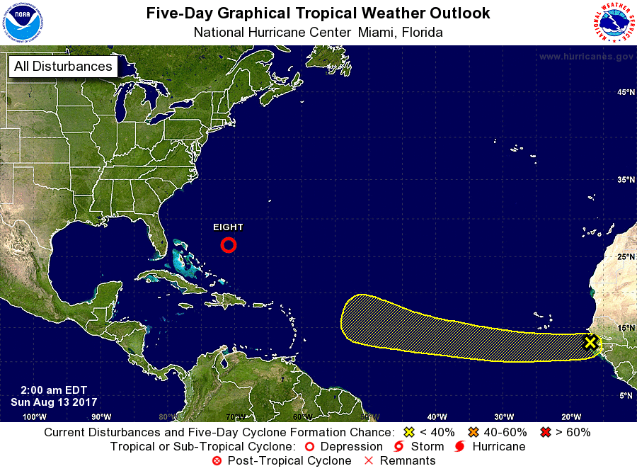 In the tropics, the wave we’ve been watching developed into Tropical Depression # 8 overnight. At 5 am Sunday, TD # 8 was located near 26.5 North, 70.9 West, and was moving north-northwest at 14 miles per hour. TD # 8 will remain well east of Florida and the Bahamas.


