


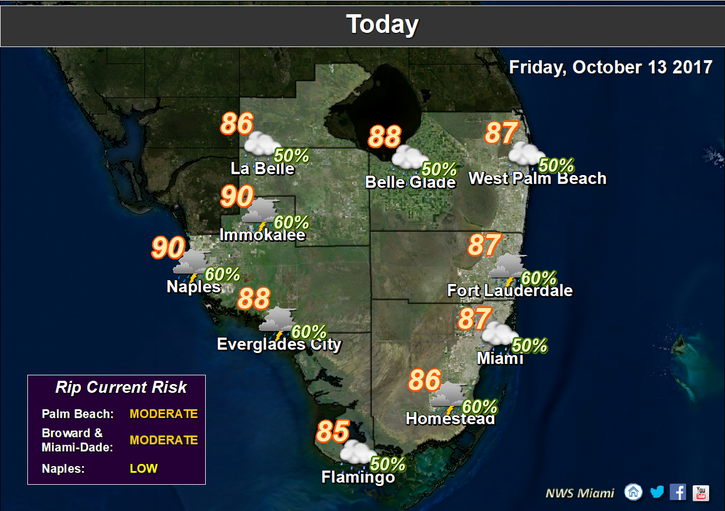
 South Florida will see more showers and storms on a strong ocean breeze on Friday as a low passes south of our area. After showers and storms overnight, Friday features additional showers and storms and breezy conditions, including an elevated risk of dangerous rip currents at the Atlantic beaches. Highs on Friday will be in the mid to upper 80s.
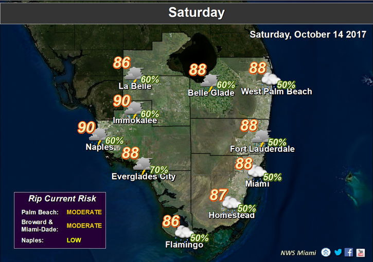 Showers and storms will be around again on Saturday, along with some periods of sun. Saturday’s highs will be mostly in the upper 80s.
Look for fewer periods of showers and storms on Sunday, with more of a mix of sun and clouds. Sunday’s highs will be in the upper 80s.
Monday will bring some passing showers on the ocean breeze, a few afternoon storms, and a mix of sun and clouds. Monday’s highs will be in the upper 80s.
Look for periods of sun, clouds and passing showers, and an afternoon storm in spots on Tuesday. Highs on Tuesday will be in the upper 80s.
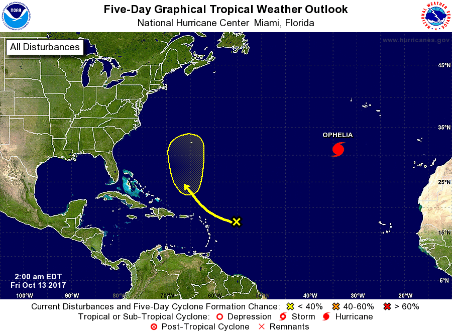 In the tropics, Hurricane Ophelia has strengthened and is finally on the move. At 5 am Friday, Ophelia was located near 31.1 North, 33.9 West, and was moving east-northeast at 8 miles per hour. Maximum sustained winds were 105 miles per hour. Ophelia will pass near the Azores on Friday. Elsewhere, a strong tropical wave several hundred miles east of the Lesser Antilles has a low chance of development as it moves generally northward.


