


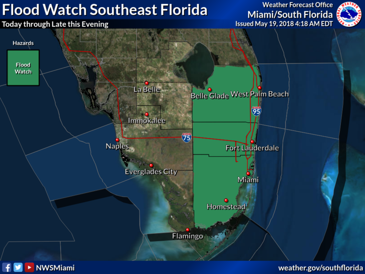
 It’s a stormy Saturday in South Florida as tropical moisture hangs around. After early showers, Saturday features clouds, showers, and some afternoon storms in spots. Two or more inches of rain are possible in some areas, and much of the eastern metro area is under a flash flood watch through Saturday evening. Highs on Saturday will be in the low 80s along the east coast and a bit warmer elsewhere.
Sunday will be another day of clouds and showers, with afternoon storms in some locations. We’ll also see an elevated risk of dangerous rip currents at the Atlantic beaches. Sunday’s highs will be in the low 80s.
Monday will bring another round of clouds, showers, and afternoon and evening storms. Monday’s highs will be in the mid 80s.
Tuesday will be another day of clouds, showers, and periods of storms. Tuesday’s highs will be in the mid 80s.
Wednesday will feature some sun along the Gulf coast, but the east coast will be mostly cloudy once again. All of South Florida can expect periods of showers and the possibility of late day storms on Wednesday. Highs on Wednesday will be in the mid to upper 80s.


