


 South Florida will enjoy a nice springtime day on Friday before another front moves in over the weekend. After a seasonable start, Friday features good sun with a few clouds and maybe a stray shower on the breeze. But there’s a high risk of dangerous rip currents at the Atlantic beaches to spoil near-perfection. Highs on Friday will be mostly in the mid 80s.
Saturday morning will be warm, with lows in the low to mid 70s. Then the day will bring sun, some clouds, an elevated risk of rip currents at the Atlantic beaches, and a few showers on the breeze. Saturday’s highs will be in the mid to upper 80s.
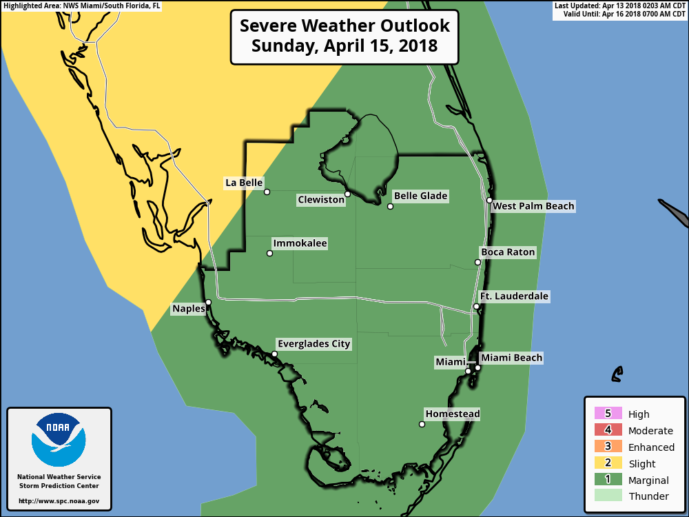 Sunday will see a front move in, and the day will be a mix of sun, clouds, and increasing showers, storms, and windy conditions. Beware of dangerous rip currents at both the Atlantic and Gulf beaches. Sunday’s highs will be in the mid 80s.
The front will clear the area overnight, and Monday morning will see lows in the mid to upper 60s. The day will feature sun, a few clouds, and maybe a stray shower. Monday’s highs will be near 80 degrees.
Tuesday’s forecast includes good sun and a few clouds. Highs on Tuesday will be near 80 degrees.
If you thought the 2017 Atlantic hurricane season was bad, the world meteorological community agrees with you. They’ve retired the names of four of last year’s storms — Harvey, Irma, Maria, and Nate. All of them are considered so damaging and deadly that those names will forever be associated with the 2017 hurricane season. Here in South Florida, we won’t soon forget our experience with Irma — and we’ll keep in mind that the 2018 hurricane season is less than two months away. Tony Spitz explains:


