


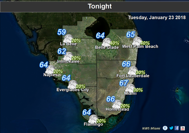
 Showers return to South Florida on Tuesday as some changes in our weather begin. After some overnight showers, Tuesday features more showers and lots of clouds as a front approaches. Highs on Tuesday will be near 80 degrees.
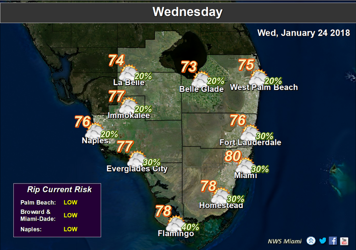 Wednesday will bring clouds and showers on the breeze, along with an increasing risk of dangerous rip currents at the Atlantic beaches. Wednesday’s highs will be in the mid 70s.
Look for lingering showers and clouds on a breezy Thursday. Thursday’s highs will be in the mid 70s.
Friday will be quite windy, and we’ll see a mix of clouds, passing showers, and periods of sun. Friday’s highs will be in the mid 70s.
Saturday will be breezy, and we’ll see a few showers along with a mix of sun and clouds. Saturday’s highs will be in the mid 70s.


