


Showers and storms will move into South Florida on Friday, as we watch the wave that is now Potential Tropical Cyclone # 9. That system is expected to be a tropical storm before long (its name will be Humberto). It’s bringing in plenty of tropical moisture and periods of gusty winds as it moves into the northwestern Bahamas today and then near the central Florida coast on Saturday into Sunday. LIVE RADAR
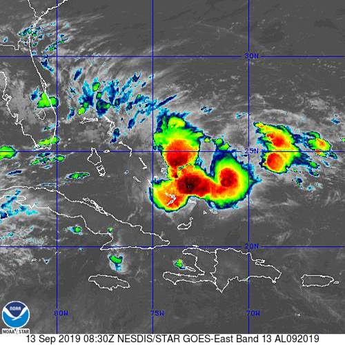 At 5 am Friday, Potential Tropical Cyclone # 9 was located near 24.6 North, 75.2 West, about 170 miles southeast of Great Abaco Island in the northwestern Bahamas. Potential TC # 9 was moving northwest at 6 miles per hour and had maximum sustained winds of 30 miles per hour. A tropical storm warning is in effect for the northwestern Bahamas (except Andros Island). A tropical storm watch is in effect for the Florida east coast from Jupiter Inlet to the Flagler/Volusia county line.
Here in South Florida, Friday features cloudy skies in South Florida, along with passing showers and storms — including brief downpours. A high risk of dangerous rip currents remains in place at the Atlantic beaches on Friday through at least Saturday night. Highs on Friday will be in the upper 80s.
Saturday will be another day of clouds, gusty winds at times, and periods of showers and storms, including heavy rain in spots. Saturday’s highs will be in the upper 80s.
Tropical moisture will linger on Sunday, so look for plenty of clouds and some passing showers and storms. Sunday’s highs will be near 90 degrees.
The Gulf coast will see a mix of sun and clouds on Monday, while the east coast metro area will remain mostly cloudy. All of South Florida will see passing showers and storms. Monday’s highs will be mostly in the low 90s.
We’ll see more sun, fewer clouds, and some quick showers and storms on Tuesday. Highs on Tuesday will be in the low 90s.
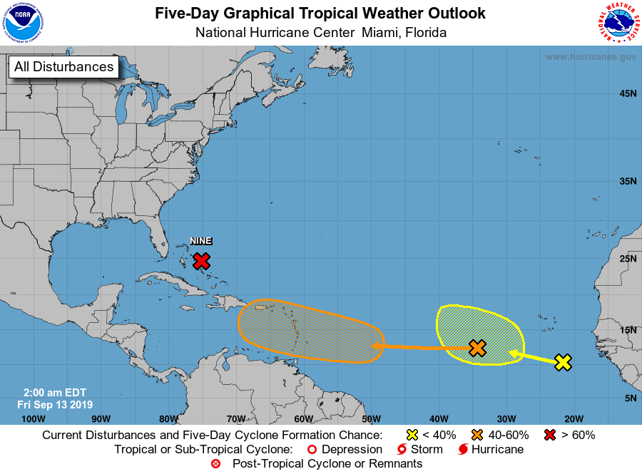 Elsewhere in the tropics, we’re watching two waves. The wave now several hundred miles west of the Cape Verde Islands is not expected to develop during the next couple of days. But it will be moving into a more favorable area and could become a depression early in the workweek. We’ll continue to watch it. And another wave has developed south-southeast of the Cape Verde Islands. This one has a low chance of development during the next several days as it moves generally westward.


