

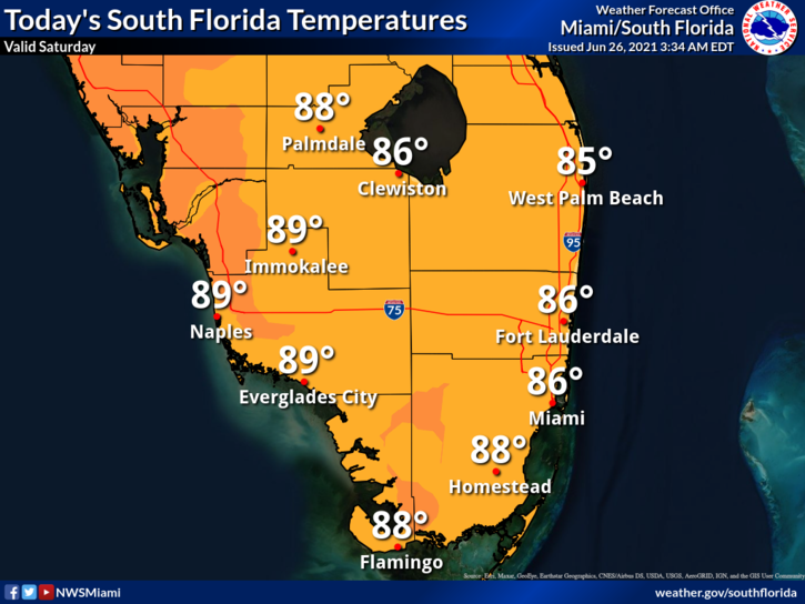
 Saturday features a mix of sun, clouds, and periods of showers and storms. A high risk of dangerous rip currents is in place at the Atlantic beaches at least through the weekend. Highs on Saturday will be in the upper 80s in the east coast metro area and near 90 degrees along the Gulf coast.
LIVE RADAR 24/7 (Click Here Then Press Play)
Sunday will be another day of widespread showers and storms alternating with sun and clouds. Sunday’s highs will be in the upper 80s in the east coast metro area and near 90 degrees along the Gulf coast.
Monday will bring an early mix of sun and clouds with showers and storms developing in the afternoon. Monday’s highs will be in the upper 80s in the east coast metro area and near 90 degrees along the Gulf coast.

Tuesday will feature partly sunny skies and mostly afternoon showers and storms. Tuesday’s highs will be in the upper 80s.
Wednesday’s forecast calls for clouds, showers, and some storms. Highs on Wednesday will be mostly in the mid-80s.
 In the tropics, the wave in the eastern Atlantic has a low chance of developing during the next 5 days.
Disclaimer
The information contained in South Florida Reporter is for general information purposes only.
The South Florida Reporter assumes no responsibility for errors or omissions in the contents of the Service.
In no event shall the South Florida Reporter be liable for any special, direct, indirect, consequential, or incidental damages or any damages whatsoever, whether in an action of contract, negligence or other tort, arising out of or in connection with the use of the Service or the contents of the Service. The Company reserves the right to make additions, deletions, or modifications to the contents of the Service at any time without prior notice.
The Company does not warrant that the Service is free of viruses or other harmful components


")