


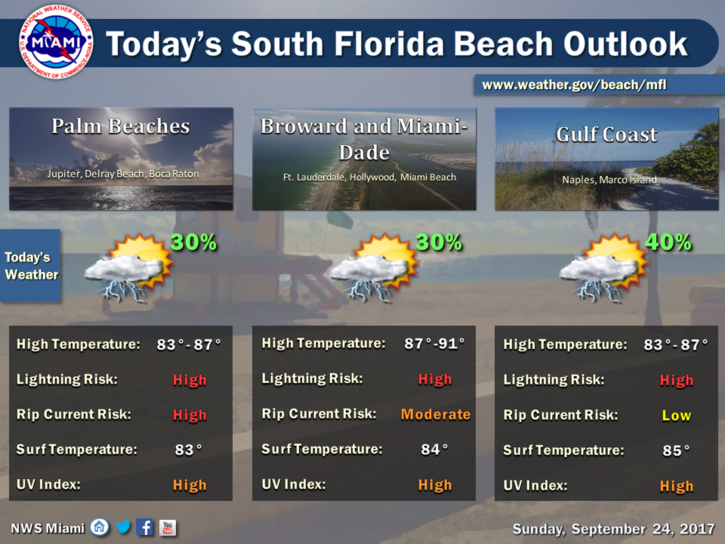
 Showers and storms will be around South Florida on Sunday. After some early showers, Sunday features some sun, some clouds, and periods of passing showers and storms, especially in Miami-Dade and the Keys. An elevated risk of dangerous rip currents is in place at the Atlantic beaches (especially in Palm Beach County) as swells from Hurricane Maria affect our coast. Highs on Sunday will be near 90 degrees.
Look for fewer showers and storms on Monday as drier air starts to move in. Monday’s highs will be in the low 90s.
Tuesday will bring a mix of sun and clouds and just a few isolated showers in spots. Tuesday’s highs will be in the low 90s.
Wednesday features sun, clouds, and maybe a stray shower. Wednesday’s highs will be in the low 90s.
Some showers and storms are back in the forecast for Thursday, along with periods of sun. Highs on Thursday will be near 90 degrees.
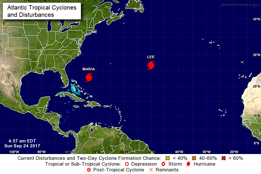 The tropics are still busy, with Hurricane Maria and now Hurricane Lee in the Atlantic. At 5 am Sunday, Maria was located near 27.9 North, 72.7 West, and was moving west at 9 miles per hour. Maximum sustained winds were 110 miles per hour. While Florida will get swells and rough surf from Maria, we’re watching its potential effects on the mid-Atlantic coast during the next few days. And Lee has intensified into a hurricane with maximum sustained winds of 85 miles per hour. At 5 am Sunday, Lee was located near 31.8 North, 50.1 West, and was inching south at 1 mile per hour. Lee is forecast to remain in the central Atlantic.


