


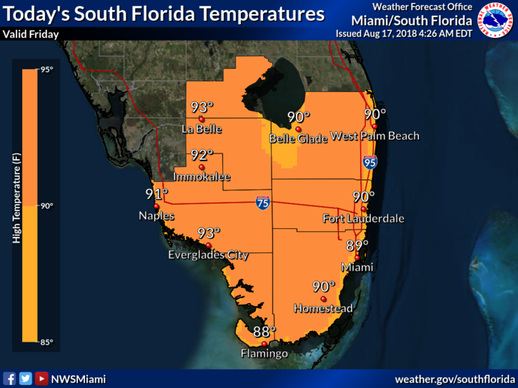
 Showers are returning to South Florida on Friday as we return to our typical rainy season weather pattern. Friday features some morning showers along the east coast, alternating with sun and clouds. Look for showers and maybe a storm in the afternoon, especially well inland. Red tide is back along the Gulf coast, so it won’t be a beach day there. Highs on Friday will be in the low 90s.
Saturday will bring sun and clouds to start (with some morning showers right along the east coast). Then we’ll see afternoon showers and storms throughout the area. Saturday’s highs will be near 90 degrees.
Sunday will feature sun and clouds to start, with showers and storms developing in the afternoon. Sunday’s highs will be in the low 90s.
Monday will repeat the pattern — sun and clouds in the morning, followed by afternoon showers and storms along the sea breezes. Monday’s highs will be in the low 90s.
Tuesday’s forecast includes a mix of sun and clouds, with afternoon showers and storms. Highs on Tuesday will be in the low 90s.
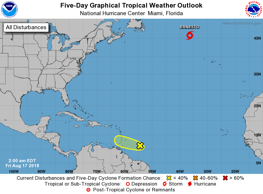 Ernesto is now a tropical storm, but not for long. At 5 am Friday, Ernesto was located near 45.6 North, 36.4 West, and was zooming northeast at 25 miles per hour. Maximum sustained winds were 45 miles per hour. Ernesto should transition to an extratropical system late on Friday and bring gusty winds and stormy conditions to Ireland late in the weekend. Elsewhere, the wave about 500 miles from the Lesser Antilles has a low chance of developing during the next few days, but it will bring heavy rain and gusty winds to some of the islands this weekend.


