Home Weather Mostly Sunny With Summery Heat

Mostly Sunny With Summery Heat

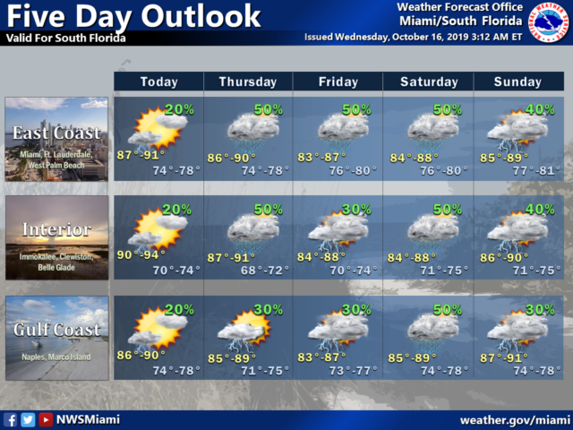
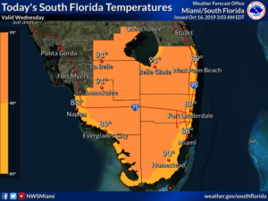
  Wednesday features plenty of sun with maybe a few clouds and a stray shower.  Tidal flooding will be a concern along the east coast again on Wednesday.  Highs on Wednesday will be near 90 degrees.

LIVE RADAR 24/7 (Click Here Then Press Play)

Thursday will bring more clouds and periods of showers and storms, especially in the east coast metro area.  Thursday’s highs will be in the upper 80s.

Friday will be cloudy with mostly east coast showers and storms as a weak front approaches.  Friday’s highs will be mostly in the upper 80s.

Faith Based Events

Look clouds, showers, and storms again on Saturday as the front stalls near our area.  Saturday’s highs will be mostly in the mid 80s.

Sunday will feature plenty of clouds but fewer showers and storms.  Highs on Sunday will be mostly in the mid 80s again.

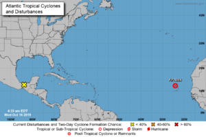
In the tropics, Tropical Depression # 15 has degenerated into a open wave as its remnants move north of the Cape Verde Islands.  Elsewhere, the low that is now over southern Mexico has a medium chance of developing into a depression over the Bay of Campeche.
[vc_message message_box_style=”solid-icon” message_box_color=”blue”]By Donna Thomas, SouthFloridaReporter.com, certified Meteorologist, Oct. 16, 2019[/vc_message]

Disclaimer

The information contained in South Florida Reporter is for general information purposes only.
The South Florida Reporter assumes no responsibility for errors or omissions in the contents of the Service.
In no event shall the South Florida Reporter be liable for any special, direct, indirect, consequential, or incidental damages or any damages whatsoever, whether in an action of contract, negligence or other tort, arising out of or in connection with the use of the Service or the contents of the Service. The Company reserves the right to make additions, deletions, or modifications to the contents of the Service at any time without prior notice.
The Company does not warrant that the Service is free of viruses or other harmful components


Donna Thomas has studied hurricanes for two decades. She holds a PhD in history when her experience with Hurricane Andrew ultimately led her to earn a degree in broadcast meteorology from Mississippi State University. Donna spent 15 years at WFOR-TV (CBS4 in Miami-Fort Lauderdale), where she worked as a weather producer with hurricane experts Bryan Norcross and David Bernard. She also produced hurricane specials and weather-related features and news coverage, as well as serving as pool TV producer at the National Hurricane Center during the 2004 and 2005 seasons. Donna also served as a researcher on NOAA's Atlantic Hurricane Database Reanalysis Project. Donna specializes in Florida's hurricane history.