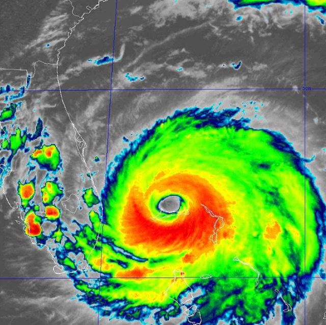
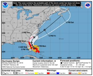
At 5 pm Monday, Dorian was located near 26.8 North, 78.4 West, about 25 miles northeast of Freeport on Grand Bahama Island. Maximum sustained winds were 145 miles per hour. Dorian remains a very powerful and dangerous category 4 hurricane.
Watches and warnings are unchanged for South Florida at 5 pm. To our north, a hurricane warning is now in effect from Jupiter Inlet to Ponte Vedra Beach, Florida. A hurricane watch is in effect from Ponte Vedra to the South Santee River in South Carolina.
South Florida can expect the closest approach from Dorian to be on Tuesday morning, but Dorian will remain well off our coast. Miami-Dade and much of Broward can expect windy conditions, gusts to tropical storm strength, and short periods of downpours when Dorian’s outer bands move through. Northeastern Broward and Palm Beach County can expect sustained tropical storm force winds and periods of heavy rain. There is a potential for 2 to 5 feet of storm surge for coastal Palm Beach County. Gusty winds and brief periods of heavy rain are expected along the Gulf coast.
Disclaimer
The information contained in South Florida Reporter is for general information purposes only.
The South Florida Reporter assumes no responsibility for errors or omissions in the contents of the Service.
In no event shall the South Florida Reporter be liable for any special, direct, indirect, consequential, or incidental damages or any damages whatsoever, whether in an action of contract, negligence or other tort, arising out of or in connection with the use of the Service or the contents of the Service. The Company reserves the right to make additions, deletions, or modifications to the contents of the Service at any time without prior notice.
The Company does not warrant that the Service is free of viruses or other harmful components