


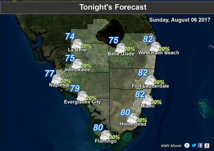
 South Florida will see a few showers and an isolated storm on Sunday, but it will still be very hot. After a few overnight showers, Sunday features a mix of sun and clouds, with afternoon showers and a storm or two forming along the sea breeze. A moderate risk of dangerous rip currents remains in place at the Atlantic beaches. Highs on Sunday will be in the low 90s near the coast and the mid 90s inland, so stay out of the sun and drink plenty of water.
Monday will bring a few early showers, a mix of sun and clouds, and a few afternoon storms. Monday’s highs will be mostly in the low 90s, with a few higher readings well inland.
Tuesday will feature an early shower or two, sun and clouds, and afternoon storms in spots. Highs on Tuesday will be in the low 90s.
Look for more of the same on Wednesday — early showers in spots, a mix of sun and clouds, and some afternoon storms along the sea breeze. Highs on Wednesday will be in the low 90s.
Thursday’s forecast includes showers and storms, along with periods of sun. Thursday’s highs will be near 90 degrees.
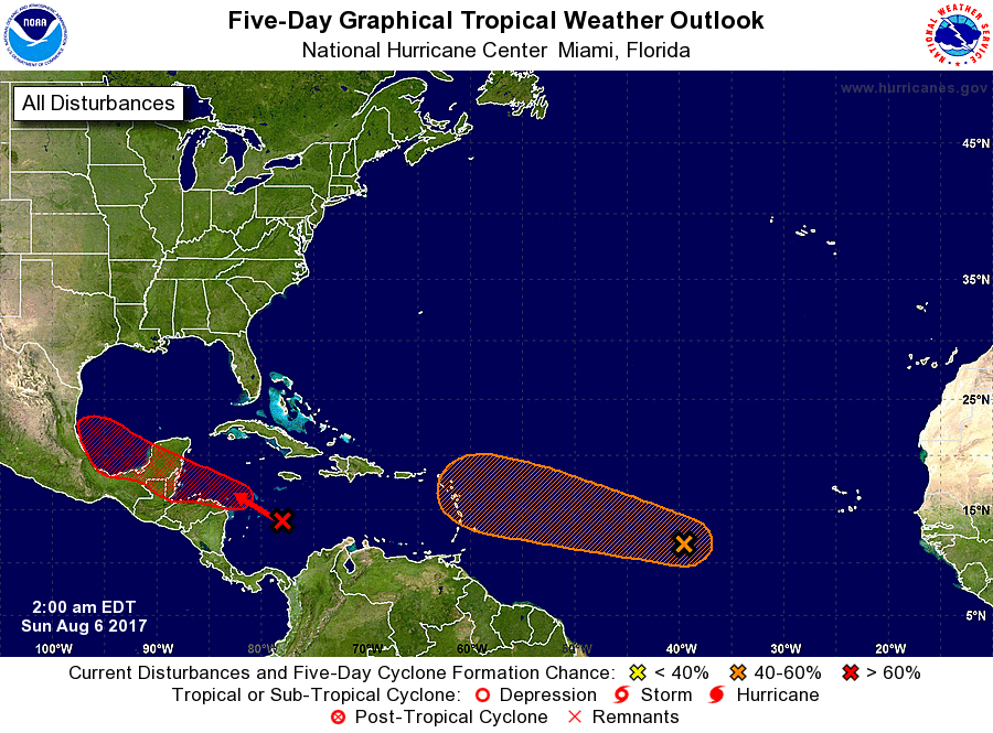 In the tropics, the wave we’ve been watching is near the central Atlantic. It now has a medium chance of becoming a depression during the next 5 days, because conditions are likely to become less favorable for development. But we’ll continue to keep a close eye on it. The wave in the Caribbean has a high chance of development and could become a depression either east of the Yucatan or in the Bay of Campeche.


