


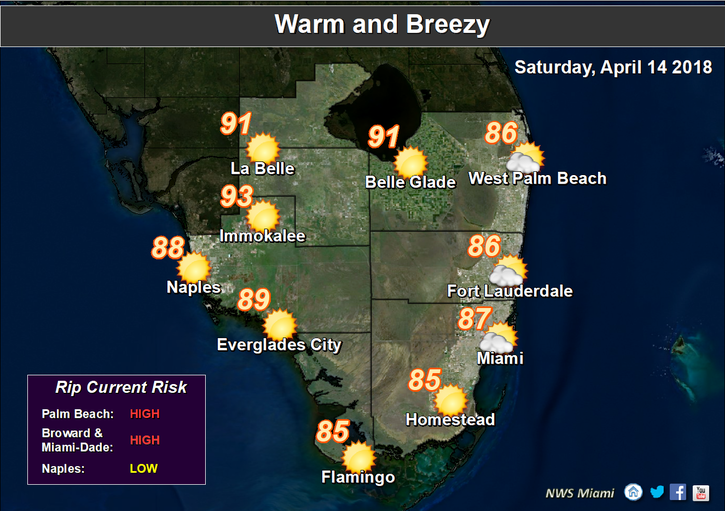
 South Florida will be hot on Saturday, and a few showers are in the forecast as well. After a warm start, Saturday features a mix of sun and clouds with a few showers on the breeze, especially at the coasts. A high risk of dangerous rip currents is in place at the Atlantic beaches on Saturday and Sunday. Highs on Saturday will be mostly in the upper 80s.
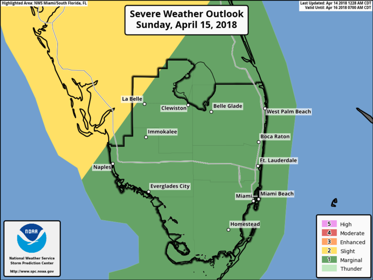 Sunday will start out on the sticky side, with morning lows in the mid to upper 70s. Then we’ll see a mix of sun and clouds, with building clouds, showers, and storms in the late afternoon and evening as a front moves in. Be on the alert for some strong storms, with heavy rain, gusty winds, dangerous lightning, and small hail. Sunday’s highs will be mostly in the upper 80s.
The front will be south of us by early Monday, and the day will start with some leftover showers followed by clearing skies. But we’ll also see an elevated risk of dangerous rip currents at the Gulf beaches. Monday’s highs will be near 80 degrees.
Tuesday will bring a cool morning, followed by plenty of sun and a few clouds. Tuesday’s highs will be near 80 degrees.
Look for more of the same on Wednesday — plenty of sun and a few clouds. Highs on Wednesday will be in the seasonable low 80s.


")