


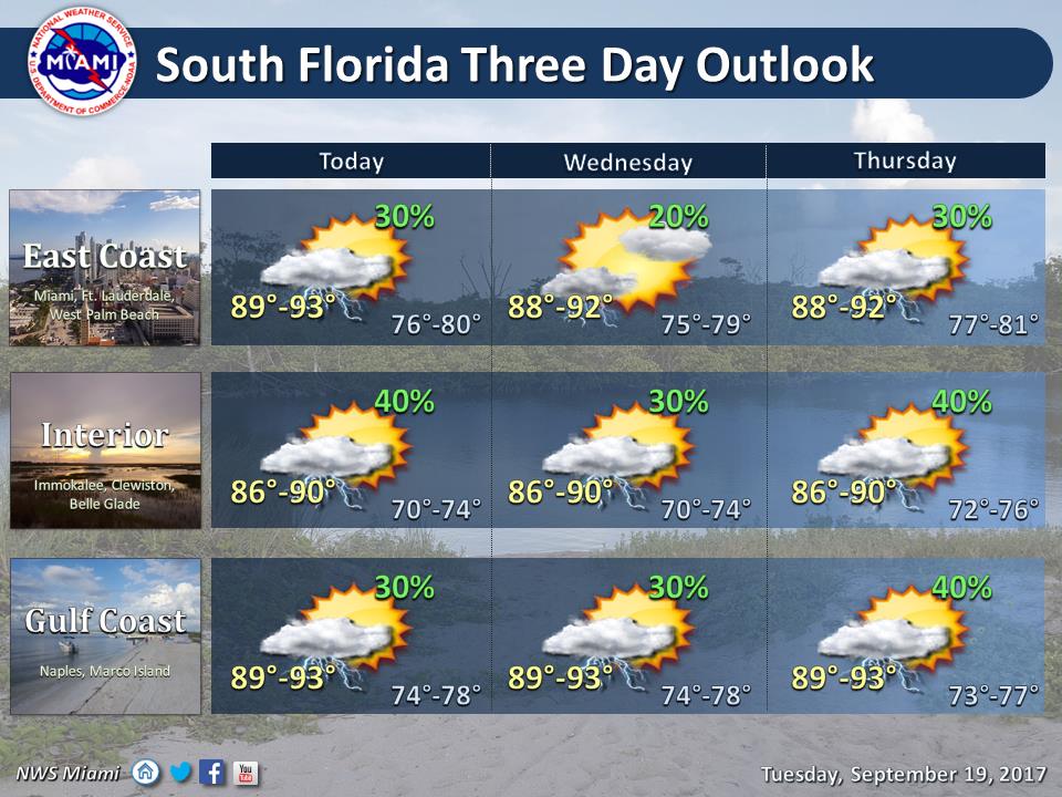
 South Florida will be hot with a few storms on Tuesday, but well to our southeast, Hurricane Maria is slamming into the hurricane-weary Leeward Islands. South Florida’s Tuesday features a mix of sun and clouds, a high risk of dangerous rip currents at the Atlantic beaches, and afternoon storms forming in spots along the sea breeze. Highs on Tuesday will be in the low 90s.
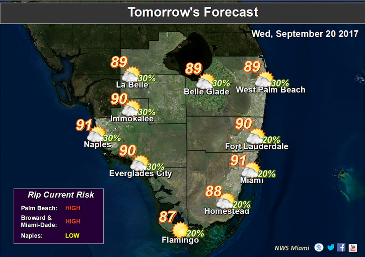 Wednesday will bring a few early showers, sun and clouds, an elevated risk of rip currents at the Atlantic beaches, and a few afternoon storms along the sea breeze. Wednesday’s highs will be in the low 90s.
Thursday’s forecast includes a few morning showers, a mix of sun and clouds, and afternoon storms in spots. Highs on Thursday will be near 90 degrees.
Friday and Saturday will see Maria well to our east, and just how far will determine what our weather will be. For now, we’ll say both days will feature good sun, a few clouds, and maybe a stray storm as drier air subsiding from Maria’s circulation influences our part of Florida. Look for highs around 90 degrees on both days.
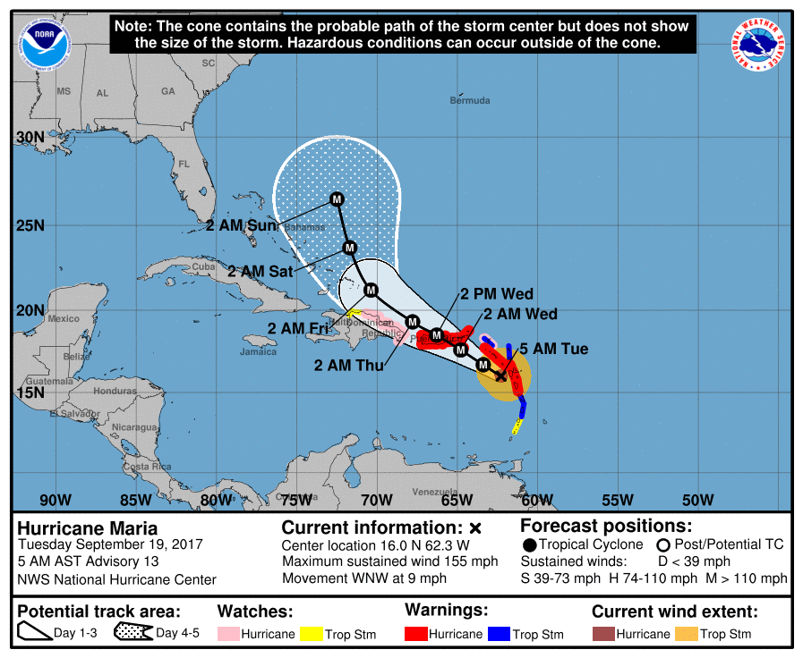 Hurricane Maria rapidly intensified on Monday and is yet another category 5 hurricane. At 5 am Tuesday, it was located near 16.0 North, 62.3 West, and was moving west-northwest at 9 miles per hour. By 5:10 am, Maria had maximum sustained winds of 160 miles per hour, despite passing over the mountainous terrain of Dominica. Maria’s forecast track will bring the system near Puerto Rico and the southeastern Bahamas before taking a more northward turn away from Florida. But this is a dangerous hurricane, so we’ll continue to watch it closely throughout the week.
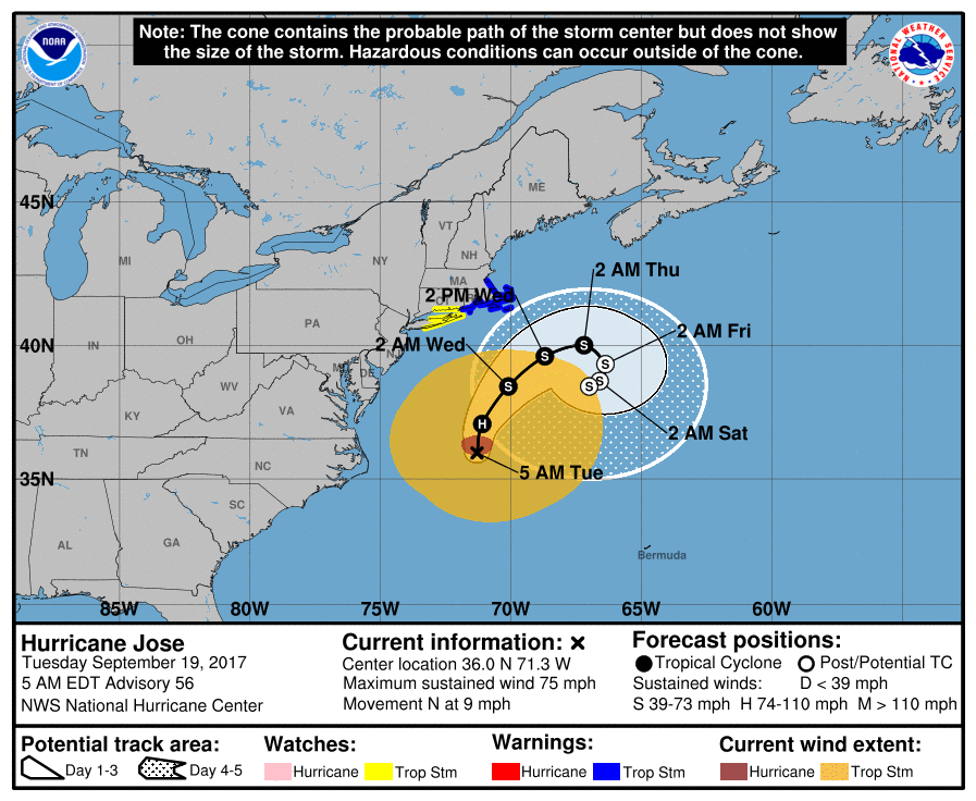 Elsewhere, Hurricane Jose is hanging off the U.S. coast with top winds of 75 miles per hour. At 5 am Tuesday, Jose was located near 36.0 North, 71.3 West, and was moving north at 9 miles per hour. And what was Tropical Depression Lee is now a remnant low.


