


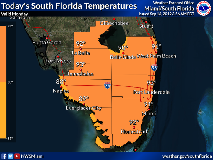
 The day features a mix of sun and clouds to start, with showers and storms popping up on a westerly breeze in the afternoon. An elevated risk of rip currents remains in place at the Atlantic beaches. Highs on Monday will be in the low 90s, but it will feel about 10 degrees hotter.
Tuesday will bring in a bit of drier air, so look for good sun, a few clouds, and the chance of a stray shower or storm. Tuesday’s highs will be in the low 90s.
Wednesday will feature plenty of sun and clouds at times, with the chance of a few quick showers in spots. Wednesday’s highs will be near 90 degrees.
Good sun and a few clouds are on tap again for Thursday, and again we’ll see the chance of an isolated shower. Thursday’s highs will be in the upper 80s.
Friday’s forecast includes plenty of sun, some clouds at times, and a few passing showers. Highs on Friday will be mostly in the upper 80s.
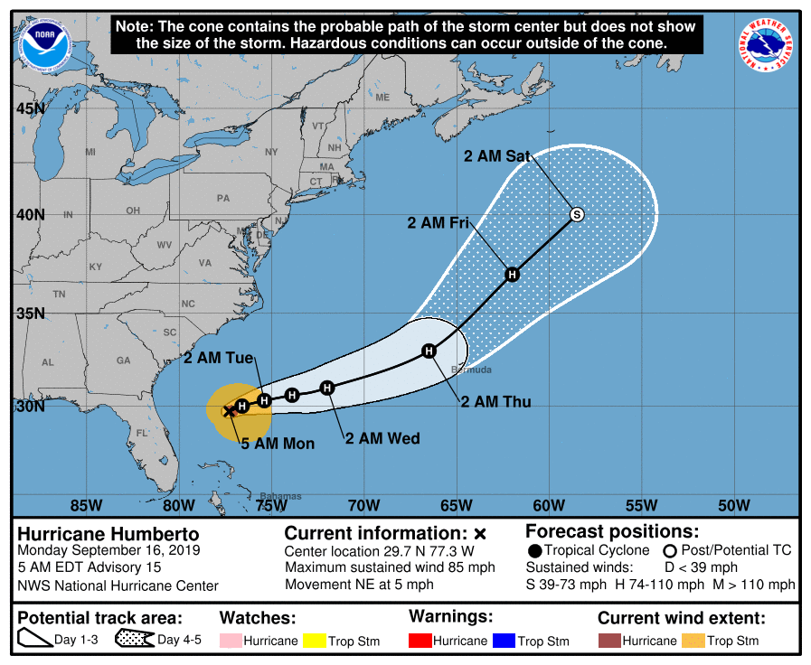 Humberto reached hurricane status overnight. At 5 am Monday, it was located near 29.7 North, 77.3 West, about 760 miles west of Bermuda. Humberto was moving northeast at 5 miles per hour. Maximum sustained winds were 85 miles per hour.
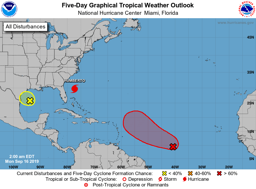 Elsewhere in the tropics, the area of showers now in the central Gulf of Mexico has a low chance of developing into a depression before it reaches the Texas coast overnight. The wave nearly the central Atlantic has a high chance of developing into a depression during the next 5 days. Computer models indicate it will bypass the Lesser Antilles and recurve well east of the Florida coast.


