


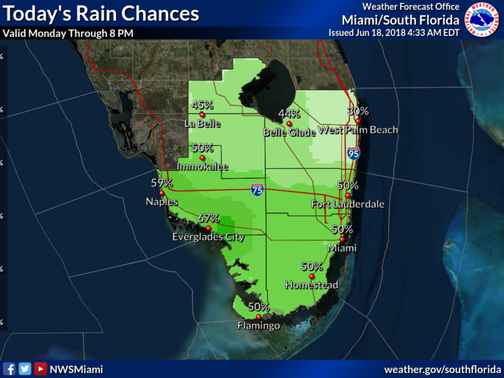
 It’s a typical June day in South Florida on Monday, with heat, storms, and showers. After a quiet start, Tuesday’s early sun and clouds will give way to showers and storms by midday along the east coast. Those showers and storms will work their way westward, and the Gulf coast can expect storms by late afternoon and into the evening, as things quiet down over the east coast metro area. Highs on Monday will be near 90 degrees, but it will feel even hotter.
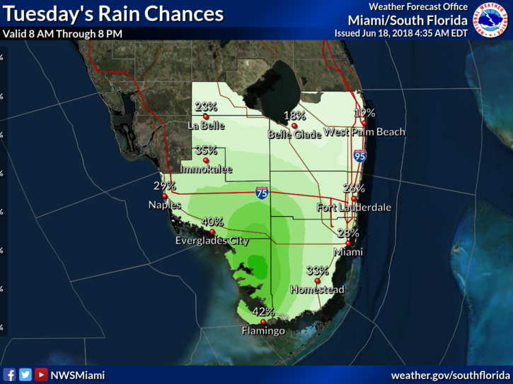 Tuesday will bring in some drier air, especially in northern parts of our area. But we can’t rule out an isolated storm or a stray shower. Tuesday’s highs will be near 90 degrees.
Look for sun, clouds, and maybe a shower or storm in spots on Wednesday. Wednesday’s highs will be in the low 90s.
Moisture will return on Thursday, so chances of showers and storms will go up. Thursday’s highs will be in the low 90s.
Friday’s forecast includes some sun, clouds, and periods of showers and storms. Highs on Friday will be in the low 90s.
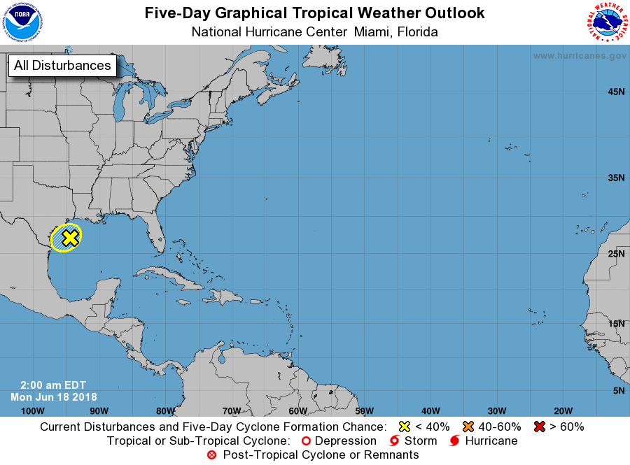 The area of showers and storms in the Gulf of Mexico is nearing the Texas coast. This system is not expected to develop into a tropical depression, but it will continue to bring heavy rain to parts of Texas and Louisiana.


")