


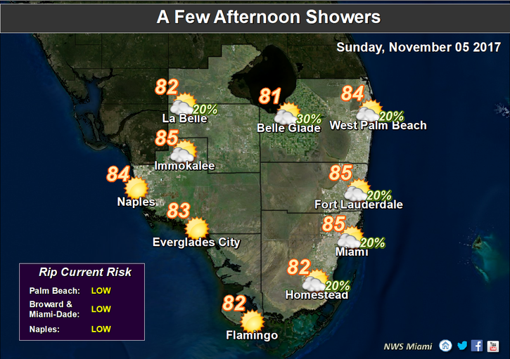
 Sun and clouds are in the forecast for South Florida on Sunday. The “extra long” day (we’ve gained an hour in the early morning hours with the start of standard time) features a nice mix of sun and clouds with a few quick showers in some spots. Some coastal flooding is possible at high tides on Sunday morning in low-lying areas along the Atlantic beaches. Highs on Sunday will be in the mid 80s.
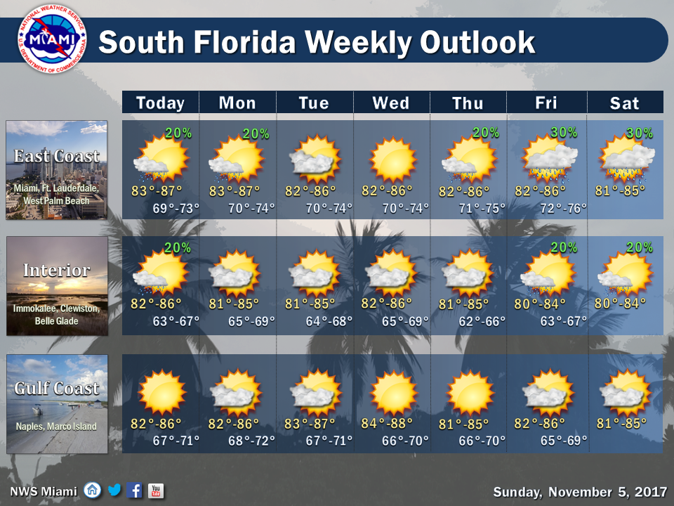 Monday will bring good sun, some clouds at times, and maybe the chance of a shower. Monday’s highs will be in the low to mid 80s.
Tuesday continues the trend, with sun, clouds, and the possibility of an isolated shower. Tuesday’s highs will be in the mid 80s.
Look for good sun and a few clouds on Wednesday. Highs on Wednesday will be in the mid 80s again.
Thursday will feature plenty of sun, a few clouds at times, and maybe a stray shower. Thursday’s highs will be in the mid 80s.
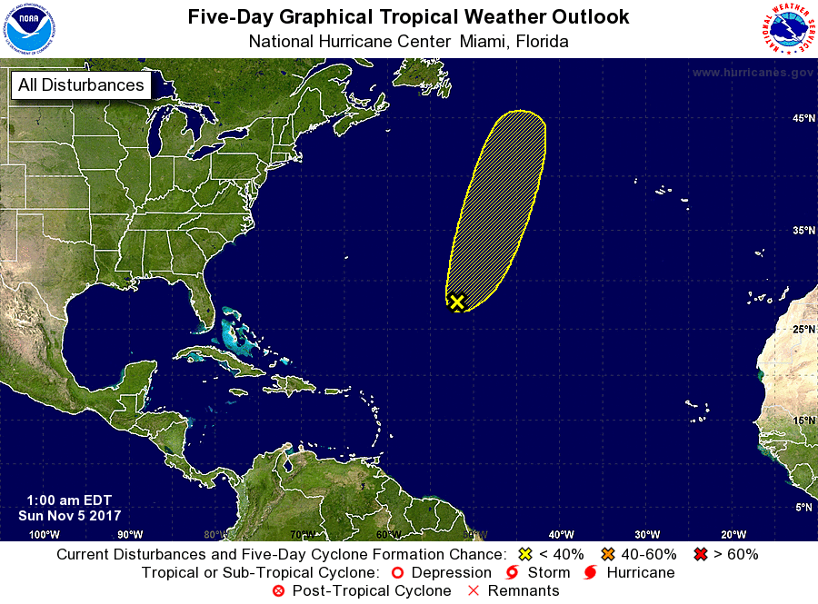 In the tropics, an area of showers and storms in the central Atlantic has a low chance of developing during the next 5 days as it moves through open waters far from land.


