


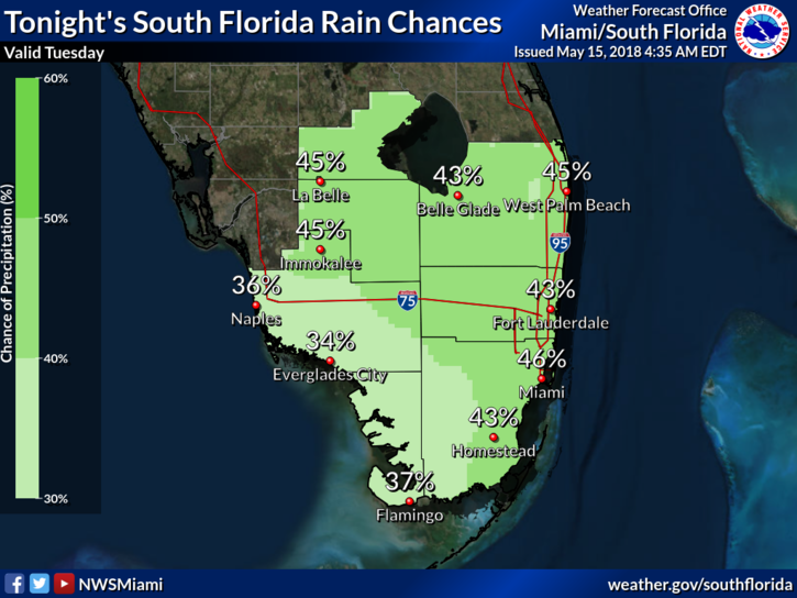
 South Florida will see more tropical rains move in on Tuesday. After a mostly dry start, Tuesday features some sun, more clouds, and showers and storms working their way northward during the late morning and afternoon. Periods of heavy rain are possible. A moderate risk of dangerous rip currents is in place at the Atlantic beaches. Highs on Tuesday will be in the mid 80s.
 Wednesday morning will be muggy, with lows mostly in the mid 70s, and we’ll see passing showers in spots. The day will bring some sun, some clouds, and periods of showers and storms. Wednesday’s highs will be in the mid 80s.
Thursday will feature a mix of sun, and showers. We’ll also see some afternoon storms in spots. Thursday’s highs will be in the mid 80s.
Showers and a few storms will be in the forecast again on Friday. Friday’s highs will be in the mid 80s.
Saturday will be see clouds, showers, and a bit of sun. Highs on Saturday will be in the mid 80s.
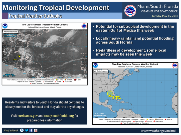
The low in the southeastern Gulf of Mexico that’s bringing us all this rain now has a low chance of developing into a tropical or subtropical depression during the next 5 days. Regardless of development, it will make South Florida soggy through the workweek and into the weekend.


