


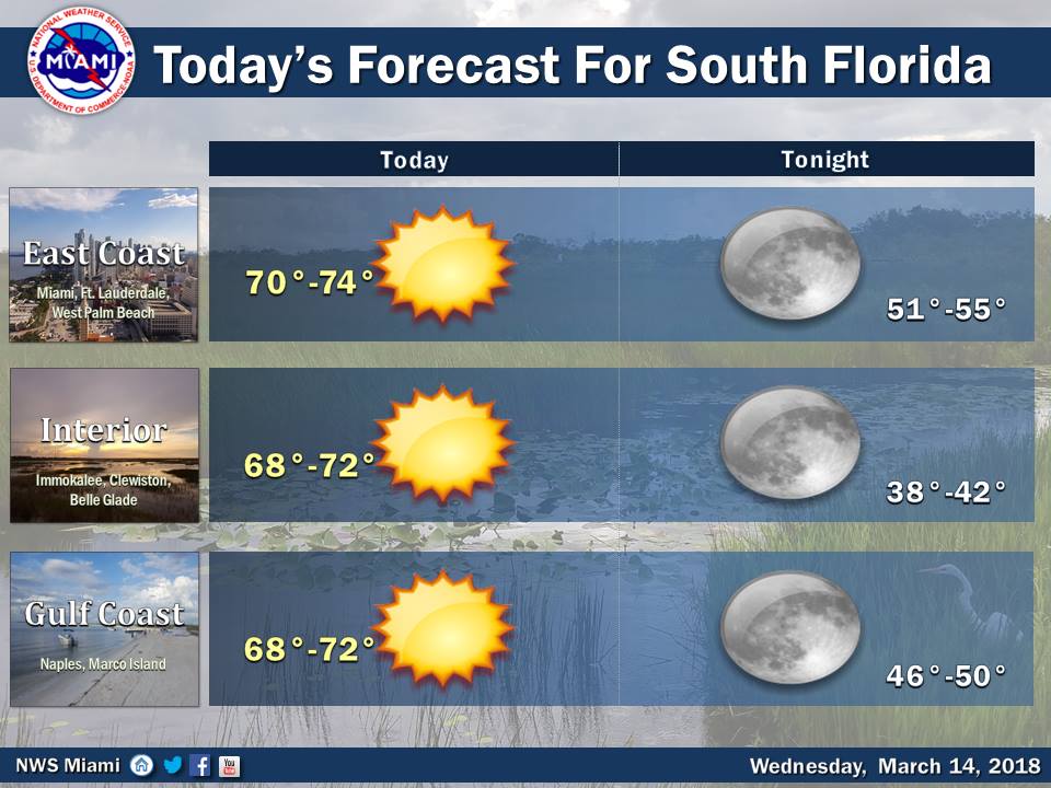
 Winter is hanging around South Florida on Wednesday, but a gradual warming trend is on the way. After a decidedly chilly start, Wednesday features lots of sun and a cool breeze. A moderate risk of dangerous rip currents is in place at the Atlantic beaches on Wednesday. Very low humidity is leading to a risk of wild fires in the interior and Gulf coast on Wednesday and beyond. Highs on Wednesday will be in the low 70s.
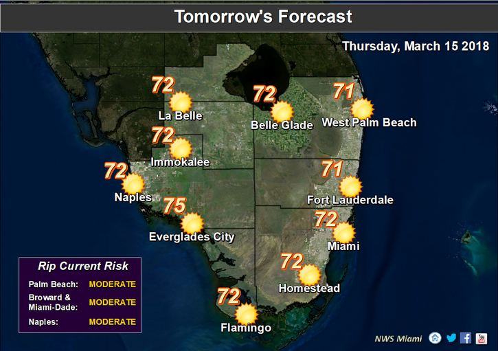 Thursday morning will be quite cold, with lows in the low 50s near the east coast and the upper 40s elsewhere. Then look for lots of sun, but that will only warm us up into the low 70s.
Friday morning will be chilly again, with lows ranging from the upper 40s to mid 50s. Then we’ll see good sun and a few clouds at times. Friday’s highs will be in the mid 70s.
Saturday will bring good sun and a few clouds for St. Patrick’s Day celebrations. Saturday’s highs will be around the 80 degree mark.
Plenty of sun and a few clouds are in the forecast for Sunday. Highs on Sunday will be in the low 80s.


