


 Winter is on the way to South Florida on Saturday, and it will stick around a while once it gets here. Saturday features a mix of sun and clouds as cooler air sweeps in late in the day. Highs on Saturday will be in the low to mid 70s.
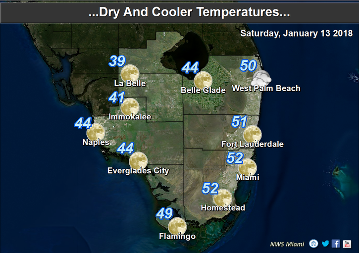
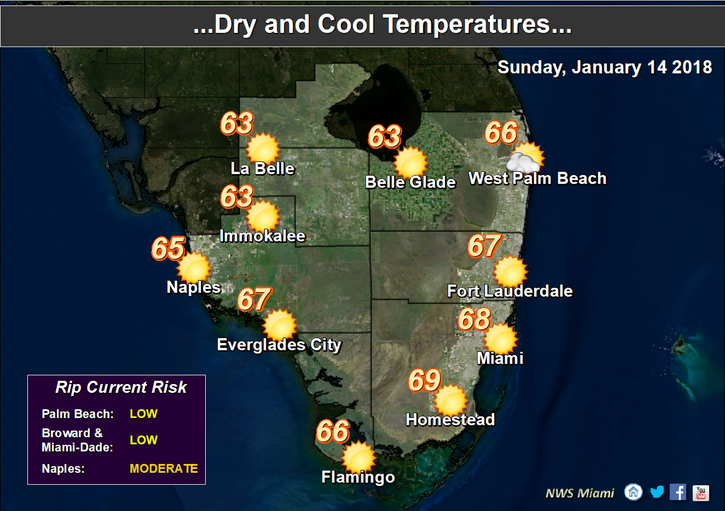 Look for a chilly Sunday morning with lows ranging from the upper 40s inland to the low 50s at the coast. Then we’ll see lots of sun and just a few clouds, but that won’t counteract the cold air. Sunday’s highs will only reach the upper 60s.
We’ll see good sun and a few clouds on Martin Luther King Day. Monday’s highs will top out near the 70 degree mark.
Some showers will return on Tuesday, but we’ll also see sun and clouds. Tuesday’s highs will be in the low 70s.
A front moves through late on Wednesday, and before it arrives, we’ll see some showers and clouds. Highs on Wednesday will be in the low 70s.


