

 Wednesday starts with lows ranging from the low 40s well inland to the low 50s at the Atlantic coast. Then the day will be sunny with a brisk and cool breeze. Look for an increasing risk of dangerous rip currents at the beaches. Highs on Wednesday will be in the low 70s.
LIVE RADAR 24/7 (Click Here Then Press Play)
Thursday morning will be milder, with lows ranging from the mid-50s to the low 60s. Then we’ll see another sunny and breezy day as a warming trend begins. Thursday’s highs will be mostly in the upper 70s.
Friday will bring good sun, a few clouds, and a shower or two in the east coast metro area. Friday’s highs will be in the upper 70s.

Saturday will feature a mix of sun, clouds, and periods of showers. Saturday’s highs will be in the upper 70s.
Sunday’s forecast calls for good sun and clouds at times. Highs on Sunday will be in the low to mid-70s.
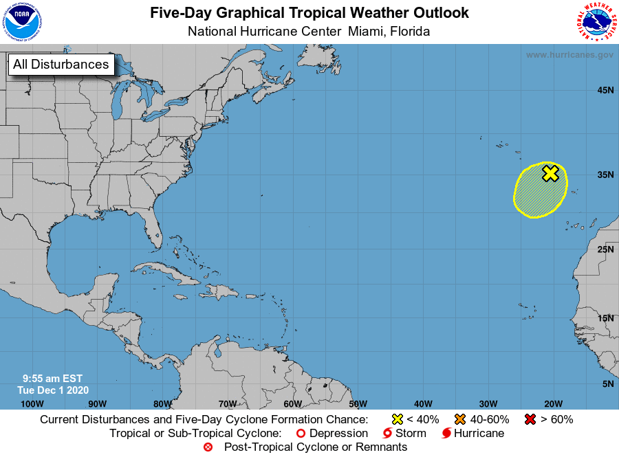 The only leftover weather feature from the 2020 Atlantic hurricane season is the low near the Madeira Islands. It’s responsible for heavy rain and gusty winds there, but it is not expected to develop into a subtropical system as it lingers in the far eastern Atlantic.
Disclaimer
The information contained in South Florida Reporter is for general information purposes only.
The South Florida Reporter assumes no responsibility for errors or omissions in the contents of the Service.
In no event shall the South Florida Reporter be liable for any special, direct, indirect, consequential, or incidental damages or any damages whatsoever, whether in an action of contract, negligence or other tort, arising out of or in connection with the use of the Service or the contents of the Service. The Company reserves the right to make additions, deletions, or modifications to the contents of the Service at any time without prior notice.
The Company does not warrant that the Service is free of viruses or other harmful components


")


")

