

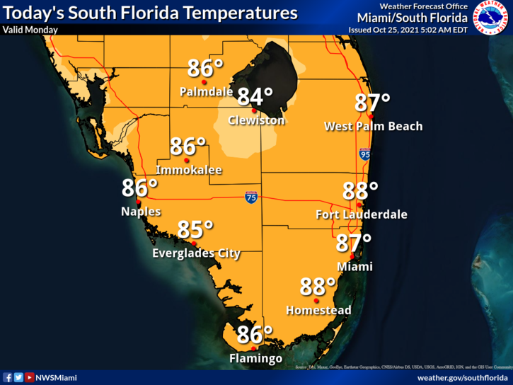
 Monday features mostly cloudy skies with periods of showers and storms. Heavy rain and localized flooding are possible. Highs on Monday will be mostly in the upper 80s in the east coast metro area and the mid-80s along the Gulf coast.
LIVE RADAR 24/7 (Click Here Then Press Play)
Tuesday will see the return of the sun, but a few showers are possible at times. Tuesday’s highs will be in the upper 80s.
Wednesday will bring lots of sun throughout the day with a few passing showers near the Gulf coast during the evening. Wednesday’s highs will be in the upper 80s in the east coast metro area and the mid-80s along the Gulf coast.

Thursday will feature plenty of clouds and showers on a strong breeze as a front approaches. Thursday’s highs will be mostly in the upper 80s in the east coast metro area and the mid-80s along the Gulf coast.
Friday’s forecast calls for breezy conditions, showers at times, and a mix of sun and clouds. Highs on Friday will be mostly in the mid-80s.
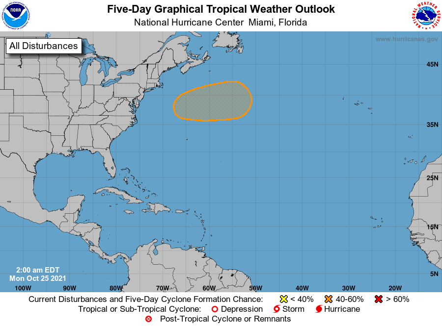 A nontropical low is expected to form off the U.S. east coast in a day or two. This system could bring gusty winds and heavy rain to portions of the northeastern coast before it moves eastward. It has a medium chance of becoming a subtropical or tropical depression during the next five days.
Disclaimer
The information contained in South Florida Reporter is for general information purposes only.
The South Florida Reporter assumes no responsibility for errors or omissions in the contents of the Service.
In no event shall the South Florida Reporter be liable for any special, direct, indirect, consequential, or incidental damages or any damages whatsoever, whether in an action of contract, negligence or other tort, arising out of or in connection with the use of the Service or the contents of the Service. The Company reserves the right to make additions, deletions, or modifications to the contents of the Service at any time without prior notice.
The Company does not warrant that the Service is free of viruses or other harmful components


