


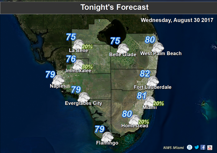
 South Florida will feel the late August heat on Wednesday as we continue to watch Tropical Storm Harvey, which made another landfall overnight. Here at home, we’ll see plenty of hot sun, some building clouds, and just a stray shower or storm, mostly inland. Highs on Wednesday will be in the low 90s at the coast and the mid 90s in the western suburbs and the interior.
 Thursday will bring the same heat and a few more showers and storms. Thursday’s highs will be in the low to mid 90s.
Some tropical moisture moves in overnight, and Friday will see passing showers and storms, along with a mix of sun and clouds. Friday’s highs will be in the low 90s.
The holiday weekend features winds shifting to the southeast, keeping most of the afternoon storms well inland. Look for hazy sun, some clouds, and the chance of a stray storm on Saturday. Saturday’s highs will be in the low 90s.
Sunday’s forecast includes plenty of sun, a few clouds, and maybe a stray storm. Highs on Sunday will be in the low 90s.
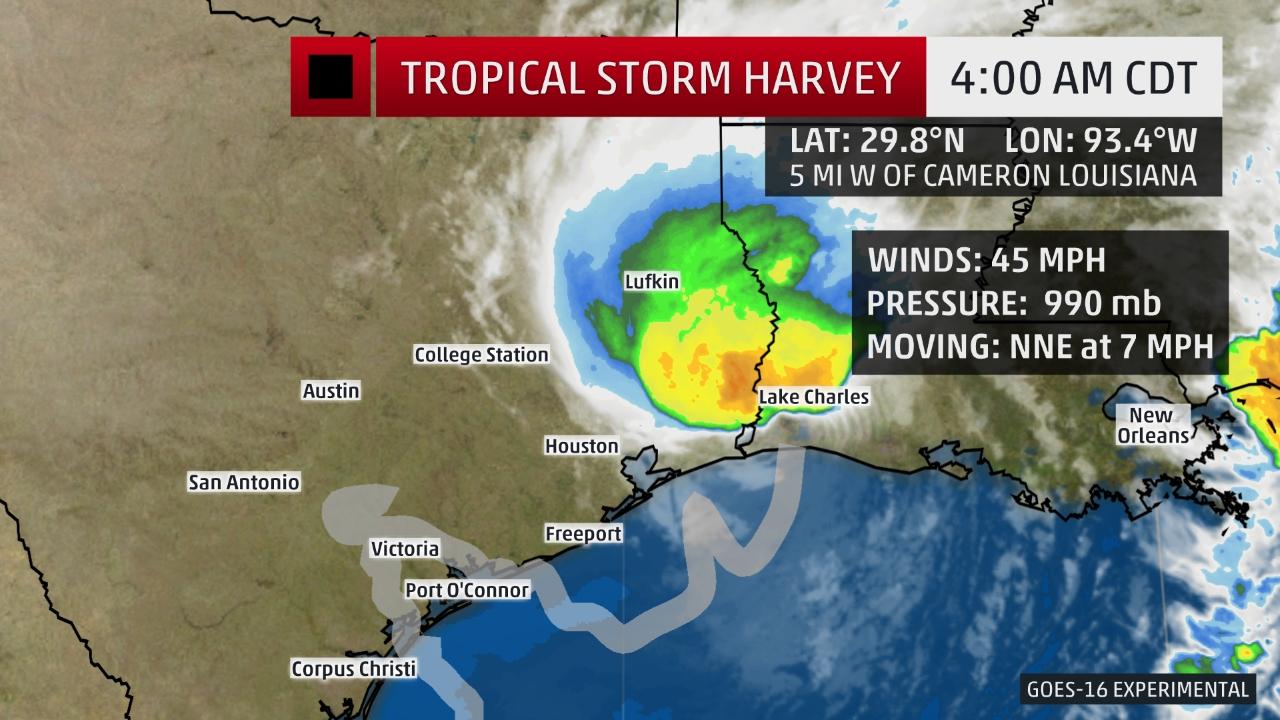 Tropical Storm Harvey has made landfall near Cameron, Louisiana as it brings flooding rains to parts of Louisiana and Texas. At 5 am Wednesday, Harvey was located near 29.8 North, 93.4 West, and was moving north-northeast at 7 miles per hour. Maximum sustained winds were 45 miles per hour, but Harvey’s winds will weaken quickly over land. Harvey could bring another 6 inches or more of rain to hard-hit areas of southeastern Texas today.
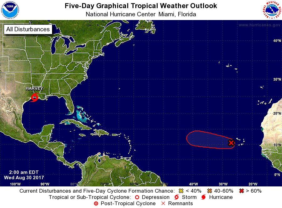 Elsewhere, what was Potential Tropical Depression 10 is not expected to develop as it moves away from the U.S. coast. The wave near the Cape Verde Islands, however, has a high chance of becoming a depression during the next day or so as it moves westward. We’ll watch that one.


